b.sc. in geoinformatics pdc01-01-05(5.1.2)...
TRANSCRIPT

B.Sc. in GeoinformaticsPDC01-01-05(5.1.2)
Page 1 of 23
UNIVERSITY OF WINDSOR
Program Development CommitteeProgram/Course Change Forms
NEW PROGRAM / MAJOR PROGRAM CHANGE APPLICATION FORMSUBMISSION DEADLINE: FEBRUARY 15
B.Sc in Geoinformatics
1. Applicant: Iain M. Samson
On behalf of: Physical Sciences/Earth Science/Computer Science
Title of Program: B.Sc. in Geoinformatics
Other Contact People: Subir Bandyopadhyay, Philip Graniero
Resource Request Review* ______________________ Date: ____________
(V.P., Academic)
2 Area: Earth Sciences Date approved:______________________________
Program Chair
AAU: Sch. of Physical Sci. Date approved:___________________________
AAU Head
AAU: Sch. of Comp. Sci. Date approved:___________________________
AAU Head
Faculty: Science Date approved: ___________________________________
Dean
3. Registrar Received Date: ___________________________________
Registrar's office
Degree Audit Review Date Completed:____________________________
Registrar's office
Assessment Date completed:___________________________________
Registrar
B.Sc. in GeoinformaticsPDC01-01-05(5.1.2)
Page 2 of 23
A. Basic Information
Faculty: ScienceAAU: School of Physical SciencesProgram Title: Geoinformatics (B.Sc.)Proposed Year of Offering: 2001 or 2002
• B. Overall Program Plan
Abstract/Summary of Proposal
This proposal is for the implementation of a B.Sc. program in Geoinformatics at the University ofWindsor. Geoinformatics deals with the collection, management, representation, and analysis ofgeospatial data. This requires graduates to have a sound knowledge of relevant areas of earth science,including geographical information systems and remote sensing, and of computer science. Thiscombination of skills will make graduates very marketable in what is a rapidly growing area foremployment.
Academic Goal
As with many other disciplines, Earth Science is experiencing a rapid enhancement of our abilities togather large amounts of data of all kinds, largely due to technological advances in areas such as GPSsystems, geophysics and geochemistry, not to mention remote sensing. Partly as a consequence, newtools are being developed that allow us to handle and analyze such data. In addition, the ever-increasingavailability of powerful computers (desktop or small servers) has led to an explosion in the developmentof software that is readily available to professionals in the industry, and maps of all kinds are mostlycomputer-drawn now. An area that is showing remarkable growth and therefore a high demand forgraduates with the relevant skills is Geographical (Geospatial) Information systems (GIS).
This program is designed to educate students in key areas of earth and computer science that willprovide them with a powerful set of skills and knowledge that comes from the combination of the twodisciplines and that will allow them to satisfy the need for graduates with both Earth and computerscience skills.
Learning Objectives
• Concepts and education in key areas of earth science. Outcome will be that students have athorough understanding of fundamental topics for areas in which geospatial and other types ofdata are gathered. This includes petrology, geomorphology, climatology, hydrology,

B.Sc. in GeoinformaticsPDC01-01-05(5.1.2)
Page 3 of 23
geochemistry and/or geophysics. The fundamental concept here is that a student has tounderstand the data being analyzed and its relevance to Earth processes;
• Concepts and education in key areas of computer science, specifically: programmingmethodologies; algorithm and data structure design and implementation; database design andmanagement; networks and distributed systems; system analysis and software applicationdevelopment, WWW technologies, computer graphics and knowledge based systems;
• Thorough education in concepts of Geospatial data management and analysis. This includes theuse of modern GIS and remote sensing software. Spatial data structures and spatial databasedesign issues; data visualization techniques; geographic analysis and modelling methods; remotesensing and field data integration; applications and limitations of geospatial data; accuracyassessment; GIS project workflow and management;
• Critical thinking and problem solving (see individual course learning outcomes);• The program will provide the students with knowledge that will allow them to work in
geoscience as geoinformatics specialists (environmental consulting, resource exploration andevaluation, conservation authorities, government agencies, etc.), but will also provide them withskills that are applicable to many other areas (non-geoscience GIS, software and web design,database management, data mining, knowledge base, image processing).
Specifically, upon graduation, students will have:• The ability to design and/or write software systems for earth science applications, including
database design and implementation;• The ability to utilize and/or customize appropriate software tools (esp. GIS and Remote Sensing
software) for the storage, retrieval and analysis of large amounts of geological and geographical(geospatial) data;
• Be well versed in the additional problems, challenges and opportunities that geospatial datacontribute to information management and analysis;
• Be well versed in the theory, methods, problems and applications of the physical "real-world"domain in which geospatial information is utilized.
• The required computer science courses make it possible for students to obtain a general B.C.S.degree.
Relationship of Goals and Objectives to University and Other Priorities
The implementation of a geoinformatics program is one of the key components of undergraduateprogram development in the Earth Sciences five year plan. Geoinformatics is also one of the three areasof research and graduate studies focus in the five year plan (the others being geochemistry andenvironmental geoscience). Geoinformatics ties in to many other program areas as, for example, GIS isused in environmental studies (biological, chemical, physical), engineering, operations research.

B.Sc. in GeoinformaticsPDC01-01-05(5.1.2)
Page 4 of 23
Justification/Rationale
There is already a high demand for students with a geoinformatics education and this demand isincreasing rapidly, particulaly in GIS. As noted above, this demand has developed out of the need forthe acquisition, organization and analysis of large data sets and the increasing sophistication of earthscience and geospatial software. The expansion of the use of geospatial software to areas outside ofearth science (traffic engineering, law enforcement, emergency services, land development, municipalland registries, etc…) is causing the market for such skills to grow even more rapidly.
The "turn of the millennium" offered a wealth of published opinions on the future of GIS from leaders ingovernmental and commercial organizations that develop and use geospatial technology. Whendiscussing the skills required for the future professionals in this industry, the common themes among allforecasts include: an ability to integrate complex geospatial databases; an understanding of networking(specifically the Internet) and distributed data sharing; specialized domain knowledge for effectiveapplication of geospatial data to problems in all sectors; and strong critical thinking and problem solvingskills.
Keynote speakers and panelists invited to speak at GIS conferences about educational needs of thefuture GIS workforce consistently describe a need for a deeper understanding of the informationtechnology behind GIS. They also identify a need for multi-disciplinary critical thinking and problemsolving skills that connect the geospatial information to the applied problems at hand.
We expect the demand for graduates with geoinformatics skills to be long term and on a national (andinternational) scale. International Data Corporation (IDC) published a report in 1999 entitled"Worldwide Spatial Information Management (SIM) Markets and Trends". They indicate that SIMmarket growth is 12% annually, with growth rates of 20 to 40% in support system segments. IDCprojects business volumes of $2.1 billion USD by 2004. This figure only includes enterprise-relatedbusiness; other segments such as geoscientific research and development produce additional volume.
Because SIM and the use of GIS is a growing field of employment and there are few similar programs inCanada and none in Ontario, there are no statistics regarding student demand (i.e.enquiries/applications). Attached are some examples of job advertisements that illustrate the demand forpeople with geoinformatics skills, and which show the need for computer science and GIS skills,combined with fundamental scientific knowledge.
With regard to professional regulatory requirements, graduates would not be expected to practice as aprofessional geoscientist in the standard manner. Exception 3 of the Prohibitions section of the draftlegislation for Bill 86 states that the prohibitions stated in section 3 (i.e. "an individual shall not practiceprofessional geoscience unless he or she is a member of the Association [of Geoscientists of Ontario]"),
B.Sc. in GeoinformaticsPDC01-01-05(5.1.2)
Page 5 of 23
do not apply to "an individual who is a land information professional whose practice is confined tomanaging geographic information". This means that professionals who deal with geoinformatics andgeospatial data would not have to register as a professional geoscientist.
However, if students registered in the geoinformatics program used all of their optional courses to takethe appropriate earth science courses, they would come very close to meeting the registration guidelines,giving them the opportunity to become professionally registered geoscientists, in addition to having thegeoinformatics degree.
Other programs that are the same or similar (in Ontario) – No other broad-based undergraduateprogram exists, as far as we know. There are a few similar programs with more limited goals.
• Queen's University GIS Certificate Programo Student is enrolled in another discipline (earth sci, biology, engineering, etc.) and takes
this as an additional programo Includes work-study componento Could conceivably combine with a computer science programo Not officially approved yet
• University of Guelph GIS Minor (Geography dept.)o Minimal requirements, limited courseso Could conceivably combine with a computer science program
• York University Certificate in GIS and Remote Sensing (Geography and Earth and AtmosphericScience depts.)
o Taken in conjunction with another major programo More course requirements than a minoro Could conceivably combine with a computer science program
It should be noted that we are currently discussing the development of GIS Certificate program inconjunction with St. Clair College.
Resources
At the present time we have the minimum number of faculty and staff that allow us to mount the program,i.e., the program can be mounted as long as the existing compliment of faculty is maintained* (i.e. thefaculty that will be retiring in the next two years, or who resign, are replaced). The program is clearlycored around GIS and remote sensing and we will be unable to expand these offerings given the currentfaculty teaching loads. This is a concern because of potential growth in GIS enrolments, teaching coursesduring sabbaticals, and the fact that most of the GIS load is placed on one, young faculty member. Thereare some additional courses that would enhance the program but that we cannot mount given our existingfaculty compliment. We would hope to be able to offer such courses in the future given additional hiringof faculty in the geoinformatics area (either through earth sciences or computer sciences or through a
B.Sc. in GeoinformaticsPDC01-01-05(5.1.2)
Page 6 of 23
joint appointment). We are adding one new course that will be required in this program, namelyWatershed Hydrology. This course will also be a very relevant course for the Environmental Science,Environmental Geoscience, and Environmental Studies programs.
Library resources are probably adequate at present. Journal holdings in Earth Sciences will be reviewedin the near future and adjustments will be made to better reflect the evolution of the department over thenext 5 to 10 years. No new library funds are being requested at this time as we need to carry out areview first.
All of the courses but one that are listed in the program exist in the 2000-1 calendar. The majority ofcourses are offered by earth sciences and computer science, who have jointly developed this proposal. Both areas expect that the required courses will continue to be offered for the foreseeable future. Othercourses required are standard/core science courses in math, chemistry and physics that will be availablefor the foreseeable future.
In general terms, the required facilities (mostly computers and software) are presently available in eithercomputer science or earth sciences. However, The GIS lab is already over-capacity and so we haverequested additional computers and support for this lab. It presently has 9 computers and has capacityfor 10 more. The GIS courses will be run in the earth sciences GIS lab (present or expanded) unlessclass sizes get too large (impact here from other programs). In this case we may run labs in othercomputer classrooms on campus (e.g. computer center, computer science, science computing lab). Wecurrently have the most up-to-date GIS software which was obtained through a negotiated licenseagreement with ESRI and which is paid from the faculty’s budget for another three years. We currentlyhave some up-to-date remote sensing software, and are in the process of purchasing more, however,future upgrades to this software cannot be covered by the existing Earth Sciences budget. Similarly, theEarth Sciences budget cannot currently handle major upgrades to the GIS or remote sensing hardware.In order to maintain high quality facilities, periodic upgrades to hardware and software will be requiredthrough an increased Earth Sciences budget or through University capital funds, the faculty budget, ITS,or through external sources (e.g., WEGC, Geosmart).
*The existing faculty complement is 12 (Al-Aasm, Duncan, Graniero, Lakhan, LaValle, Rodrigues,Samson, Simpson, Smith, Symons, Trenhaile, Turek). Note the following:This does not include Fryer who is apparently supernumery, i.e. he is not part of Earth Sciences officialcomplement and is not paid from our budget. Nevertheless, Fryer will be crucial to teaching in ourvarious programs (and, of course, in research and graduate studies).
B.Sc. in GeoinformaticsPDC01-01-05(5.1.2)
Page 7 of 23
• This does not include Hudec, who retired this year (no replacement).• This does not include Blackburn, who resigned a couple of years ago (no replacement).• Duncan has just resigned• Smith and Turek will retire in July 2001.• LaValle and Symons will retire in July 2002.
Monitoring and Evaluation
The Earth Sciences five year plan monitoring committee will monitor the development of theGeoinformatics program. This will include the analysis of data on applications to, and enrolment in, theprogram. Once the program is in place, longer term monitoring will include progress through theprogram (attrition), graduation rates, and, where possible, employment profiles. Student feedback willbe obtained regarding course load and sequencing, and overall student satisfaction.
C. Program Details
Course Requirements
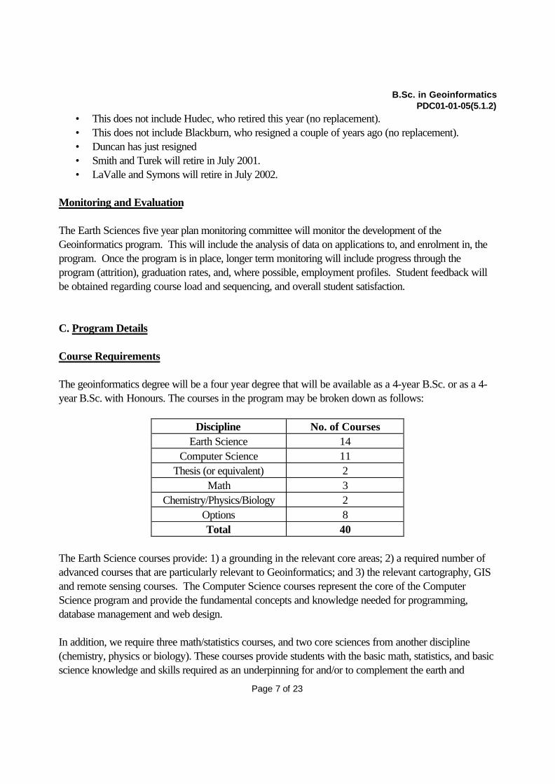
The geoinformatics degree will be a four year degree that will be available as a 4-year B.Sc. or as a 4-year B.Sc. with Honours. The courses in the program may be broken down as follows:
Discipline No. of CoursesEarth Science 14
Computer Science 11Thesis (or equivalent) 2
Math 3Chemistry/Physics/Biology 2
Options 8Total 40
The Earth Science courses provide: 1) a grounding in the relevant core areas; 2) a required number ofadvanced courses that are particularly relevant to Geoinformatics; and 3) the relevant cartography, GISand remote sensing courses. The Computer Science courses represent the core of the ComputerScience program and provide the fundamental concepts and knowledge needed for programming,database management and web design.
In addition, we require three math/statistics courses, and two core sciences from another discipline(chemistry, physics or biology). These courses provide students with the basic math, statistics, and basicscience knowledge and skills required as an underpinning for and/or to complement the earth and

B.Sc. in GeoinformaticsPDC01-01-05(5.1.2)
Page 8 of 23
computer science courses. The chemistry core courses are required for certain upper level earth sciencecourses so that the choice of first year science courses will in part dictate what earth science courses aresubsequently taken.
Optional courses allow students to obtain more courses in both of the main discipline areas, i.e. tomaintain a broad selection of courses, or to specialize in one area or the other.
Program Requirements
OAC: English, Calculus, Algebra and Geometry, and either Chemistry, Physics or Biology. Chemistrywould be required for students who wish to become professionally licensed geoscientists in geology andboth chemistry and biology would be required for students wishing to become professional licensed inenvironmental geoscience. More on this below.
Earth Science requirements: Fourteen courses, including 61-140, 61-141, 61-232, 61-280, 67-100,67-102, 67-210, 67-246, 67-310, 67-402, 67-410, plus three of 61-220, 61-224, 61-230, 61-231,61-323, 61-430, 61-436, and 67-320.
Computer Science Requirements: Eleven courses: 60-100, 60-140, 60-141, 60-212, 60-254, 60-255, 60-265, 60-315, 60-322, 60-330, and 60-334.
Earth or Computer Science: 60-499 or 61-499 or one additional 61- or 67- course and oneadditional 60- course.
Other Requirements:(a) Two courses from 55-140, 55-141, 59-140, 59-141, 64-140 and 64-141.(b) 62-120, 62-130, and 65-253(d) Eight additional courses from any area of study (including Earth or Computer Science). A list ofsuitable courses is available from the Department of Earth Sciences. Students should choose optionalcourses in consultation with an academic counselor.
Professional Licensure in Geology
Of the eleven required Earth Science courses listed above, six would count towards licensure. The threeoptional courses (suitably chosen) would count, making nine in total. If all eight options under (c) areused to take appropriate Earth Science courses and the thesis is taken in Earth Science, students wouldfall one course short (19, need 20) of the necessary geoscience requirements for licensure. However,one advanced computing course is allowed for credit in electives and so the requirements could be met,just. If students took chemistry 140 and 141 under (a) and were allowed to count three of theintroductory computer science courses in their basic math and science requirements (9 courses are

B.Sc. in GeoinformaticsPDC01-01-05(5.1.2)
Page 9 of 23
required), then they would be short one physics course (64-140).
In conclusion, assuming students have OAC chemistry, calculus, and algebra & geometry (physics 140does not require OAC physics), they would be able to meet most of the requirements for professionallicensure in geology, the exception being one physics course. This is ignoring possible scheduling issues,which would mainly come with fitting the appropriate geoscience electives into the degree.
Professional Licensure in Environmental GeoscienceOf the eleven required Earth Science courses listed above, seven would count towards licensure. Thethree optional courses would count, again, suitable chosen, making ten in total. If all eight options under(c) are used to take appropriate Earth Science courses and the thesis is taken in Earth Science, studentswould fulfill the necessary geoscience requirements for licensure. If students took chemistry 140 and 141under (a) and were allowed to count two of the introductory computer science courses in their basicmath and science requirements (9 courses are required), then they would be short two biology or twophysics courses (They need 55-140 and 141 or 64-140 and 141).
In conclusion, assuming students have OAC chemistry, calculus, and algebra & geometry, and possiblybiology, they would be able to meet most of the requirements for professional licensure in environmentalgeoscience, this time, the exception being two biology or physics courses. As with geology, this isignoring possible scheduling issues.
Required Courses
In what follows, option 1 represents the core science courses. Students must take the two core coursesfrom chemistry, physics or biology. Option 2 represents the upper level earth science courses: studentsmust take 3 of the 8 listed. Three of these, 61-220, 224, and 231 are sequenced such that the corechemistry 140 and 141 are prerequisites.

B.Sc. in GeoinformaticsPDC01-01-05(5.1.2)
Page 10 of 23
Sequencing
The sequences given below are three possible permutations for the program, depending on whetherchemistry, physics or biology and taken in first year. Note that in the non-honours stream, studentswould replace the thesis with two more options.
Course # Title Discipline Geoinformatics Prerequisites
55-140 Biological Diversity Biology option 1 OAC biology recomm
55-141 Cell Biology Biology option 1 55-140
59-140 General Chemistry I Chemistry option 1 OAC chemistry OC
59-141 General Chemistry II Chemistry option 1 59-140
60-100 Key Concepts in Computer Science Computer Science required none
60-140 Problem Solving, Programs and Computers Computer Science required none
60-141 Introduction to Programming Computer Science required 60-100 & 140
60-212 Advanced Programming Computer Science required 60-100, 140 & 141
60-254 Data Structures and algorithms Computer Science required 60-212
60-255 File Structures Computer Science required 60-212
60-265 Computer System Organization Computer Science required 60-212
60-315 Data Base Management Computer Science required 60-212, 254, 255 & 265
60-322 Object Oriented Software Design Computer Science required 60-212, 254, 255 & 265
60-330 Operating Systems Fundamentals Computer Science required 60-212, 254, 255 & 265
60-334 World Wide Web Computer Science required 60-212, 254, 255 & 265
67-100 Introduction to Geomorphology Geography required none
67-102 Atmosphere and Climate Geography required none
67-210 Principles and Applications of Geographical Information SystemsGeography required none
67-246 Introduction to Aerial Photography and Cartography Geography required none
67-310 GIS Problem Solving and Spatial Modeling Geography required 67-210
67-320 Watershed hydrology Geography option 2 61-141
67-402 Remote Sensing Geography required 67-246 OC
67-410 GIS and Spatial Decision Support Systems Geography required 67-310
61-140 Earth Systems I: The Solid Earth Geology required none
61-141 Earth Systems II: The Earth’s Surface Geology required none
61-220 Introduction to Mineralogy Geology option 2 59-140 & 141
61-224 Introduction to Geochemistry Geology option 2 59-140 & 141
61-230 Plate Tectonics and the Earth's Interior Geology option 2 none
61-231 Crustal Processes and Products Geology option 2 61-140 & 220 OC
61-232 Modern and Ancient Sedimentary Environments Geology required 61-141
61-280 Field Camp I Geology required 61-231 & 232
61-323 Stratigraphy Geology option 2 61-232
61-327 Structural Geology Geology option 2 61-231
61-430 Environmental and Engineering Geophysics Geology option 2 none
61-436 Hydrogeology Geology option 2 61-141, 62-141 OC
62-120 Linear Algebra I Math required OAC algebra & geometry
62-130 Introduction to Calculus Math required OAC Calculus
65-253 Statistics for the Sciences Math required Grade 12 adv. level math
64-140 Introductory Physics I Physics option 1 OAC Calculus
64-141 Introductory Physics II Physics option 1 64-140

B.Sc. in GeoinformaticsPDC01-01-05(5.1.2)
Page 11 of 23
• Course details and outcomes for required Earth and Computer Science courses
• Earth Science Courses
Title: Earth Systems I: The Solid EarthCourse #: 61-140
• Course ObjectivesMost students who enter university have had no exposure to Earth Science. This course is designed as a foundationcourse for earth and environmental science students and as a survey course for others. It introduces key concepts inEarth Science and provides a broad understanding of how the Earth operates and important issues and applicationsof Earth Science.
• Calendar DescriptionIntroduction to Earth System Science. The Earth's component systems and their interrelationships. Origin and natureof the solar system. Earthquakes, seismology and the Earth's interior. Plate tectonics. Minerals. Magmatism andigneous rocks. Geologic time, stratigraphy and sedimentary rocks. Crustal evolution, metamorphic rocks anddeformation. Hydrothermal systems. Mineral and energy resources. (2 lecture, 2 laboratory hours a week.). Thiscourse is designed for Science majors.
• Course OutcomesSee course description for cognitive development. Skills development, problem solving and critical thinking aspects:
Key: Comp. Sci ChemistryGeology MathGeography PhysicsBiology
Geoinformatics (chemisty taken)
F1 W1 F2 W2 F3 W3 F4 W41 60-100 65-253 60-212 60-254 60-315 option 60-330 60-3342 60-140 60-141 60-265 60-255 option 61-280 60-322 option3 61-140 61-141 62-120 62-130 option option 60/61-499 60/61-4994 67-100 67-102 67-246 67-210 61-232 61-231 67-402 option5 59-140 59-141 61-220 61-224 option option 67-310 67-410
Geoinformatics (physics taken)
F1 W1 F2 W2 F3 W3 F4 W41 60-100 65-253 60-212 60-254 60-315 60-322 60-330 60-3342 60-140 60-141 60-265 60-255 option option option 61-4363 61-140 61-141 62-120 62-130 option option 60/61-499 60/61-4994 67-100 67-102 67-246 67-210 67-310 67-320 67-402 61-4305 64-140 64-141 61-230 61-232 option option option 67-410
Geoinformatics (biology taken)
F1 W1 F2 W2 F3 W3 F4 W41 60-100 65-253 60-212 60-254 60-315 60-322 60-330 60-3342 60-140 60-141 60-265 60-255 option option option 61-4363 61-140 61-141 62-120 62-130 option option 60/61-499 60/61-4994 67-100 67-102 67-246 67-210 67-310 67-320 67-402 61-4305 55-140 55-141 61-230 61-232 option option option 67-410
Year 1 Year 2 Year 3 Year 4
Year 1 Year 2 Year 3 Year 4
Year 1 Year 2 Year 3 Year 4
B.Sc. in GeoinformaticsPDC01-01-05(5.1.2)
Page 12 of 23
identification and interpretation of the properties of the important mineral groups; characterization and interpretion ofthe mineralogy, textures and structures of common rock types; the interpretation of basic geological relationships indeciphering geological history; interactive and critical thinking exercises using plate tectonics software, interpretationof seismograms and calculation of earthquake epicentre locations, elementary reading and interpretation oftopographic and geological maps. Interactive web-based exercises and critical thinking problems.
Title: Earth Systems II: The Earth’s SurfaceCourse #: 61-141Course Objectivessame as 140 but for surfacial processes. Also provides civil and environmental engineers with basic geologicalknowledge required for their degrees.Calendar DescriptionThe Earth's surficial systems: surface processes, the hydrosphere and biosphere. Oceans. Streams. Groundwater.Glaciers. Deserts. Weathering and related phenomena. Sediments, fossils, time and paleoenvironmental analysis.Evolution of the biosphere. This course is designed for Science and Engineering majors. (2 lecture, 2 laboratory hoursa week.) Course OutcomesSee course description for cognitive development. Also: Processes associated with the present Earth's surface;weathering, erosion and the deposition of sediments; modern and ancient environments including fluvial, lacustrine,glacial and aeolian deposits; landforms associated with glacial deposits; the classification and identification of landslides; the geologic time scale; the age of sedimentary strata based on invertebrate organisms; principles ofstratigraphy; the currents and sediments of the World Ocean; the relationship between the ocean, atmosphere andclimate; the Earth's atmosphere though time; the invertebrate fossil record; the hydrologic cycle and groundwatersystems.Skills development, problem solving and critical thinking aspects: Identification of sediments, sedimentaryrocks and invertebrate fossils; interpretation of depositional environments of sedimentary rocks; correlation of stratabased on fossils; interpretation of geologic maps; identification of glacial features; evaluation of groundwater flow.
Title: Introduction to MineralogyCourse #: 61-220Course ObjectivesMinerals are fundamental to most natural processes and so a knowledge of mineralogy is critical to earth andenvironmental science and to being able to study and understand more advanced topics in these areas. It alsoimportant for geologists to be able to recognize and identify minerals using their physical properties.Calendar DescriptionAn introduction to the natural inorganic materials of the Earth: minerals, rocks, water and gases. Topics include theprinciples of symmetry and crystallography; inorganic chemistry of natural materials and crystal chemistry; thephysical chemistry of natural processes and the stability of minerals and mineral assemblages; and the processes ofcrystallization. (Prerequisites: 59-140, 59-141.) (2 lecture, 3 laboratory hours a week.) Course OutcomesSee course description for cognitive development. Skills development, problem solving and critical thinking aspects:describing, identifying and classifying mineral species in order to determine their crystal symmetry and assign them toappropriate systems and classes. Understanding the relationships among bonding, symmetry and physicalproperties, and knowledge of the principal controls on chemical substituition in minerals and of isomorphous andpolymorphic minerals, twinning and defect lattices. The ability to utilize mineral assemblages to define the principalrock groups and mineral deposits and knowledge of the conditions under which they form. Students develop theirability to visualize relationships in 3D.
Title: Aqueous and Environmental GeochemistryCourse #: 61-224
B.Sc. in GeoinformaticsPDC01-01-05(5.1.2)
Page 13 of 23
Course ObjectivesIntroduces students to key concepts in geochemistry. Builds upon principles from introductory chemistry and showstheir application to the chemistry of natural materials. This includes a survey of the general chemistry of naturalmaterials. Geochemical investigations commonly generate vast amounts of quantitative data; understanding theprinciples and processes that control the chemistry of natural materials is fundemental to handling the extensivegeochemical data bases that exist.Calendar DescriptionWater chemistry-chemical reactions and equilibria, oxidation and reduction, adsorption, ion exchange. Characteristicsof natural waters: rivers and lakes, subsurface waters, sea water. Water purity and water contaminants. Chemicalweathering. Organic geochemistry, Geochemical cycles. Geochemical aspects of global change. (Prerequisites: 59-140,59-141.) (3 lecture hours a week, including tutorials.) Course OutcomesSee course description for cognitive development. Skills development, problem solving and critical thinking aspects:Tutorials focus on problem solving. Problems relate to lectures, are geological/environmental in nature, and cover thefollowing: chemical reactions, solubility, ionic strength, precipitation, Eh, pH, oxidation-reduction.
Title: Plate Tectonics and the Earth's InteriorCourse #: 61-230Course ObjectivesBuilds on fundamental concepts from 61-140 about the Earth’s internal structure and gives students a fundamentalunderstanding of the Earth's internal processes and how these relate to plate tectonics. This material is fundamentalto a full understanding of the Earth and also introduces some basic concepts in geophysics.Calendar DescriptionPlate tectonic processes and the major features of crustal evolution; analysis of the Earth's interior using seismologicand other geophysical evidence; introductory tectonic and geophysical problems. (2 lecture, 2 laboratory hours aweek.)Course OutcomesSee course description for cognitive development. Also: Students learn how the Earth's internal structure has beendetermined, and how thermal gradients and viscous flow in the interior control plate tectonics. Plate tectonics, in turn,is the process that forms the crustal features that form the Earth’s surface such as ocean basins, continents, mountainbelts, earthquake zones, volcanic belts, etc. Understanding plate tectonic processes is difficult because the majorfeatures of crustal evolution require the student to think in three dimensions when most visualize in two, on a timescale of billions of years when most think in tens at most, and on a scale of thousands of kilometres when most thinkin hundreds at most. This course discusses the crustal processes and features, describing the scientific techniquesused to gather the information. For the Earth’s dynamic interior this has been particularly challenging technologicallybecause direct observation is not possible.. Skills development, problem solving and critical thinking aspects: Thelaboratory/tutorial time emphasizes problem solving at an elementary level to illustrate the geophysical methods usedto acquire geological information remotely, particularly seismic methods for the Earth’s interior but other methods alsosuch as heat flow, to determine rates of plate tectonic processes, and to characterize structural deformation in rocks.
Title: Crustal Processes and ProductsCourse #: 61-231Course ObjectivesThe bulk of the Earth's crust comprise rocks that are fromed or modified by crustal processes. Thus, earth sciencestudents need some fundamental knowledge of such processes because any study or interpretation of rocks has tobe based on an understanding of how they form. Students learn about the relevant processes and learn the keytextural and mineralogical characteristics of rocks and how they are related to processes. They are then able todescribe and interpret rocks.Calendar DescriptionOrigin and differentiation of the Earth. Formation, character and metamorphism of oceanic crust. Subduction of

B.Sc. in GeoinformaticsPDC01-01-05(5.1.2)
Page 14 of 23
oceanic crust: processes, products and consequences. Formation and evolution of continental crust: structure of thecontinents, igneous processes and products, and metamorphism. (Prerequisite: 61-140, 61-220, or consent ofinstructor) (2 lecture, 3 laboratory hours a week.) Course OutcomesSee course description for cognitive development. Also: Understanding the formation of the chemical elements andthe differentiation of the earth.. A knowledge of metamorphic zones and metamorphic facies. Knowledge of thestructure and composition of the oceanic and continental crust and the plate tectonic processes, includingdivergence, subduction and collision, leading to their formation Skills development, problem solving and criticalthinking aspects: The ability to describe, identify and classify igneous and metamorphic rocks. Utilization of phasediagrams to establish the physical and chemical conditions and processes by which they form. The identification oflithotectonic assemblages and the crustal environments in which they form and use of this knowledge to reconstructancient plate movements.
Title: Modern and Ancient Sedimentary EnvironmentsCourse #: 61-232Course ObjectivesSediments are the principle products of surficial geological processes and hold the clues to unravelling earth history,beit 5 years or 5 million years. This course deals with characteristics and interpretation of the sediments formed invarious surficial environments and the biota that are associated with these environments. It introduces students tothe techniques used in deciphering these paleoenvironments. Again, this is a core area for earth science students.Calendar DescriptionAn integrated approach to paleontology and sedimentology; introduction to sedimentary deposits, sedimentaryenvironments and associated invertebrate organisms; depositional systems and peleonenvironmental analysis.(Prerequisite: 61-141) (2 lecture, 3 laboratory hours a week.)Course OutcomesSee course description for cognitive development. Also: The classification of sediments and sedimentary rocks;modern depositional environments of sediments and their equivalents in the stratigraphic record; invertebrateorganisms associated with modern environments and their fossil equivalents; an introduction to sedimentary facies.Skills development, problem solving and critical thinking aspects: Identification of sediments, sedimentary rocks,sedimentary structures and accompanying invertebrate organisms; interpretation of ancient environments based onlithologic associations and accompanying invertebrate organisms.
Title: Field Camp ICourse #: 61-280Course ObjectivesEarth Science is ultimately a field-based discipline as we are dealing with the unravelling of Earth processes. It is thus critical that students gain field experience. This course is designed to introduce students to field methods and tointroduce them to interpreting field relationships. Students cannot learn about or appreciate the interpretation ofrelationships beyond th ehand-specimen scale without going into the field.Calendar DescriptionIntroduction to field relationships and mapping methods. Interpretation of geologic maps. Required field trips. (2weeks; immediately following the winter term examination period.) (Prerequisites: 61-231 and 61-232).Course OutcomesSee course description for cognitive development. Skills development, problem solving and critical thinking aspects: Techniques in the description of rocks in the field. Methods of collection of field data and samples. Interpretation offield relationships and geologic history. Laboratory methods of sample preparation. Report writing and mapconstruction. Students have to learn to work in teams so they learn about task sharing and cooperation.
Title: Environmental and Engineering GeophysicsCourse #: 61-430

B.Sc. in GeoinformaticsPDC01-01-05(5.1.2)
Page 15 of 23
Course ObjectivesVirtually all environmental and engineering site studies involving the Earth’s surface require the determination of thegeologic (physical and chemical) properties of the underlying soils, rocks and contained water. Such sites aretypically studied both directly by drilling and indirectly by geophysical methods. The latter methods are typicallydone both to locate where best to drill and to correlate data between drill holes. Thus knowledge of the many diversemethods used to acquire geophysical information is essential to the training of environmental and engineering Earthscientists.Calendar DescriptionAn introduction to the use of seismic, electrical, electromagnetic and other geophysical methods used in near-surfaceenvironmental and engineering assessment studies. (2 lecture, 3 laboratory hours a week.)Course OutcomesSee course description for cognitive development. Also: The course describes the theory, field techniques, basicequations and interpretation of data for the geophysical methods that are currently used to acquire near-surfacegeologic information. The methods include surface, gravitational, magnetic, reflection and refraction seismologic,electrical, induced potential, electromagnetic, ground penetrating radar, geothermal and radiation methods, includingvariants of each, with a concluding commentary on borehole geophysical methods. Skills development, problemsolving and critical thinking aspects: The laboratory exercises, in some cases using field equipment, are focussed onthe analysis and interpretation of field data. The aim is to enable the student to run and interpret simple geophysicalsurveys and/or to understand and converse with geophysicists who are planning or have run such surveys.
Title: HydrogeologyCourse #: 61-436Course ObjectivesHydrogeology is a key area of applied geoscience and is needed by any professional geoscientist working in theenvironmental field. Because groundwater is a major exploitable water resource which must be managed, anunderstanding of hydrogeology is essential. Groundwater provides a transport medium for contaminants andminerals and plays a significant role in a number of geological processes affecting development of mineral deposits,petroleum reservoirs, and geologic structure.Calendar DescriptionFundamental physics and properties of groundwater flow in porous geologic material, develops an intuitive, problem-solving approach to hydrogeologic problems. Topics include: groundwater flow equations, flow nets, aquiferpumping, contaminant transport processes, two-phase flow, and dense non-aqueous phase liquids. Computerapplication will be emphasized. (Prerequisite: 61-141 62-141 or equivalent or consent of instructor.) (3 lecture, 2laboratory hours a week.).Course OutcomesSee course description for cognitive development. Skills development, problem solving and critical thinking aspects: Promote understanding of groundwater flow and contaminant transport using typical problems. Computer softwarefor the solution of flow nets, pump test analysis, and contaminant transport are used. Quantitative assessment isemphasized where possible. Impact of quantitative results are stressed such as inplications of over-pumping or riskof exposure.
Title: Introduction to GeomorphologyCourse #: 67-100Course ObjectivesThis course is one of the foundation courses for BA and BSc degrees in geography, resource management, andenvironmental science and serves as a science option for large numbers of non-science students. The course isconcerned with the geological processes that operate on the Earth's surface, and the resulting landforms andlandscapes. Calendar DescriptionThe landscapes of the earth, with particular reference to the glaciers, coastlines, rivers, and northern permafrostregions of Canada. (3 lecture hours a week.)

B.Sc. in GeoinformaticsPDC01-01-05(5.1.2)
Page 16 of 23
Course OutcomesSee course description for cognitive development. Skills development, problem solving and critical thinking aspects:Students learn how natural processes sculpt our physical environment, and how human activities effect, and arebeing effected by, the natural environment.
Title: Atmosphere and ClimateCourse #: 67-102Course ObjectivesTo introduce students to the fundamentals of meteorology and climatology, which are fundamental areas in earth andenvironmental science.Calendar DescriptionAn introduction to the atmosphere and the basic principles of meteorology and climatology. Topics include weathersystems, atmospheric pollution and inadvertent climate modification, climate change and relationships betweenclimate and living organisms. (3 lecture hours a week.)Course OutcomesSee course description for cognitive development. Skills development, problem solving and critical thinking aspects:Students learn how weather influences humans, and how humans are altering the atmosphere. Students arechallenged weekly to critically examine a currrent environmental problem and develop novel and innovative solutions.
Title: Principles and Applications of Geographical Information SystemsCourse #: 67-210Course ObjectivesGIS recently became part of the high school curriculum in Ontario, but most students are currently expected to haveminimal or no exposure to GIS. Although the students enrolled in the course are predominantly from a Geography orGeology background, most with some cartographic skills from first year, there are some students enrolled from otherdisciplines such as Sociology, Business, Biology, and Engineering that do not have this base skill set. This coursebrings all students to the same base digital cartographic proficiency, then delivers the fundamental base knowledge ofwhat GIS is and how it may be used in real-world applications. Although it is designed as the first course in aprogressive stream, students who choose not to continue with the later courses will have developed a solid skill baseto apply GIS tools and methods in their chosen field of work.Calendar DescriptionThis course emphasizes the principles, techniques, and applications of GIS. Lectures and laboratory exercises willfocus on how to acquire, store, manipulate, and analyze spatial and non-spatial data. Data conversion, datareformatting, and data base development techniques will be explained. Students will create geographic coverages andlearn techniques in the operation of a GIS by completing "hands-on" projects with modern GIS software. (It isrecommended that students take 67-246 before taking this course. (2 lecture, 3 laboratory hours a week.)Course OutcomesSee course description for cognitive development. Also: Through the course, the students will gain an understandingof and appreciation for the following fundamental concepts: the differences between digital cartography and GISanalysis; the unique aspects of spatial vs. non-spatial problems and problem solving; the role of GIS in exploring andsolving spatial problems; GIS as a structure and toolbox for spatial problems; and the properties and limitations ofspatial data, data collection and data usage. Skills development, problem solving and critical thinking aspects:Students will learn and apply a basic, systematic approach to GIS project planning that will be built upon in the latercourses. They will use real-world data obtained from diverse sources and in varied formats to explore current spatialproblems. Further work with the data will begin developing abilities to discover, visualize and communicate spatialrelationships. In the process, students will gain practical experience with a common commercial GIS package (ESRIArcView) that is in demand on the job market.
Title: Introduction to Aerial Photography and Cartography (modified course)Course #: 67-246

B.Sc. in GeoinformaticsPDC01-01-05(5.1.2)
Page 17 of 23
Course ObjectivesThe course is designed to expose students to the basic properties, and use of maps and aerial photographs, and toprepare them for more advanced work in geographical information systems and remote sensing.Calendar DescriptionBasic concepts involved in cartographic theory and design, including map projections, longitude, latitude and UTMgrid systems, and thematic and topographic maps, and the fundamentals of aerial photographs and other remotelysensed data (visible spectrum, infra-red and radar), satellite imagery, photogrammetry and photointerpretation. (2lecture, 2 laboratory hours a week).Course OutcomesSee course description for cognitive development. Skills development, problem solving and critical thinking aspects: Students are exposed to the qualatative and quantative use of maps and aerial photographs. They will learn: how todesign maps; how to calculate and use scales, the characteristics of various types of map projections; longitude,latitude and the UTM system for locating points on the Earth's surface; how to draw topographical profiles and thetechniques used to portray relief on maps; and how to plot spatial statistical data. They will learn to calculate scaleson aerial photographs, to measure elevation, to draw accurate maps from inaccurate photographs, the use of radar,infrared and other remotely sensed data, and the use of satellite imagery. They will also learn to read and interpretethe significance of the information shown on maps and aerial photographs.
Title: GIS Problem Solving and Spatial ModelingCourse #: 67-310Course ObjectivesIn 67-210, students gained an understanding of what GIS is and how to use GIS to explore basic spatial problems. 67-310 is designed to encourage students to creatively apply that fundamental knowledge to a wider, more complex rangeof problems. Beyond analysis of existing real-world conditions, a common demand for GIS analysts centers onconstruction of simulation and predictive spatial models, whether to investigate and scientifically explain observedprocesses or to explore "what if?" management alternatives. This course leads students through the questions"Where are things located?" to "Why are they located there?" and provides them with the skills to answer them usingGIS.Calendar DescriptionThis course will concentrate on the utilization of numerical, spatial, and digital elevation models, and integration of allGIS data, including those from air photographs, GPS receivers, and remote sensing satellites. The application ofspatial statistics and integration of models in a GIS will be explained. Macro languages and spatial algorithms will beutilized, and techniques for spatial modeling toward decision making will be applied. Exercises will provide "hands-on" experience in the use of GIS and models for problem solving in various disciplines. (Prerequisite: 67-210.) (2lecture, 3 laboratory hours a week.)Course OutcomesSee course description for cognitive development. Also: Through the course, the students will gain an understandingof and appreciation for the following advanced concepts: expansion of the GIS concept beyond analysis of staticmaps; GIS analyses as repeatable methods that may be automated; the use of GIS for spatial representation of bothobserved and hypothetical scenarios; formalization of real-world processes within the context of a GIS' spatialrepresentation; analysis results depend upon the quality of input data and the method of analysis. Skillsdevelopment, problem solving and critical thinking aspects: Students learn how to analyze an unstructured problemdefinition in order to design and implement an appropriate structured solution. They learn to adapt their "ideal"designs to the (possibly insufficient) data that is actually available. This design and adaptation experience allowsthem to critically analyze the results of other GIS approaches for their relative strengths and weaknesses. They learnto operationalize their designs as an automated GIS workflow through script writing, constructing their ownspecialized tools from the basic GIS toolbox. For Geoinformatics students, this course is their first direct linkagebetween GIS and the programming skills learned in the Computer Science stream. Further work with commoncommercial GIS packages (ESRI ArcView, ArcInfo) strengthens their practical experience.

B.Sc. in GeoinformaticsPDC01-01-05(5.1.2)
Page 18 of 23
Title: Remote SensingCourse #: 67-402Course ObjectivesGiven the great demand for students who are capable of analyzing and interpreting remotely sensed data and imageryfor natural resources, ecological and environmental applications, this course has core objectives relating to theprovision of instruction on data acquisition and data applications from various multispectral, thematic mapping andradar remote sensing systems. Complementing this objective will be the utilization of contemporary image processingtechniques for analyzing digital remote sensing data. Another objective will focus on the introduction of techniquesfor spectral image interpretation, pattern recognition, and discrimination of features on remotely sensed images.Calendar DescriptionAn integrated course dealing with contemporary principles and applications of aerospace remote sensing. Emphasiswill be placed on scanning systems; multispectral sensors; the identification and interpretation of spectral signatures;how the imagery obtained by sensors is analyzed optically or digitally to yield earth resource information; and themanipulation and display of remotely-sensed data. (Prerequisite: 67-302 or consent of instructor.) (2 lecture, 1.5laboratory hours a week.)Course OutcomesSee course description for cognitive development. Skills development, problem solving and critical thinking aspects:Students will learn the fundamental principles of data acquisition from the various spectral bands in theelectromagnetic spectrum, and develop skills in the utilization of imaging processing techniques for analyzing digitalremote sensing data. Through applied laboratory and computer-based exercises students will learn the sequence ofsteps necessary for converting uncorrected, digital remote sensing data to geometrically rectified maps. Skills will,therefore, be acquired in the utilization of multivariate statistical techniques for discriminating and classifying spatialfeatures. By analyzing and interpreting the data characteristics from multispectral, thermal, and radar scanningsystems students will be trained in the assessment of biogeophysical resources, and the solution of environmentalproblems.
Title: GIS and Spatial Decision Support SystemsCourse #: 67-410Course ObjectivesMany of the high-demand, high-paying jobs advertised in the GIS industry are in the area of GIS applicationdevelopment. This course gives students an opportunity to develop such a system. Having mastered GIS techniquesto solve specific problems in 67?310, students expand their horizons to consider how to approach general classes ofproblems, and construct a system that allows others to explore and analyze a specific set of spatial problems. ForGeoinformatics students the course is the culminating integration of the knowledge gained from the Earth Science andComputer Science streams, with the possible exception of 60- or 61-499 (Thesis).Calendar DescriptionThis course will examine and apply GIS as an analytical tool for effective decision making and efficient problemsolving. Spatial data queries, data linkages, and knowledge-based systems will be discussed. The integration of adatabase sub-system, model base sub-system, and a spatial dialogue sub-system will be introduced. Each student willformulate and operationalize a major, independent project to demonstrate that GIS is a useful subset of a spatialdecision support system, essential for problem solving. (Prerequisite: 67-310.) (2 lecture, 3 laboratory hours a week.)Course OutcomesSee course description for cognitive development. Also: Through the course, the students will build a strongerunderstanding of and appreciation for: the connections between fundamental GIS principles and solution of generalspatial problems; abstraction of generalized problem classes from specific problem cases; the role of GIS as aspecialized toolbox within the universe of other problem-solving tools; and the role of GIS analysis within the broadersocial context of science, management, and the public. Skills development, problem solving and critical thinkingaspects: The students will continue refining their problem-solving skills from 67-310, but with more consideration ofcontingencies and deviations from the "ideal" problem. By working through the major project component of thecourse, students will encounter and learn to deal with all phases of a typical software project, developing individual
B.Sc. in GeoinformaticsPDC01-01-05(5.1.2)
Page 19 of 23
and team project management skills in a low-risk environment. On the technical side, the project will give students anopportunity to integrate GIS software tools directly with other specialized software packages, e.g. Microsoft Access(database), Statistica (statistical analysis), ER Mapper (remote sensing), an important emerging area of opportunity onthe job market. To groom them for the realities of the GIS work environment, student "consultants" will give writtenreports and live presentations of proposal, progress, and finished product to the instructor "client management andtechnical staff".
Title: Watershed hydrology (new course)Course #: 67-320Course ObjectivesMost of our degree programs, existing or proposed, prepare students for various careers in the environmental sector.Whether their work lies in research, analysis, development, or management, an understanding of the underlyingenvironmental processes is paramount. This course provides the foundation for understanding hydrologicalprocesses and the role of water in environmental systems, just as other intermediate level courses address theatmospheric, geomorphological, geological, chemical, and biological processes. Water access and water quality areimportant and growing environmental management concerns. An understanding of the physical principles governingwater systems at the watershed scale gives students the knowledge and skills to address these problems andconsider opportunities in this growing employment sector.Calendar DescriptionFundamental processes in physical hydrology that control movement and storage of water within a watershed orcatchment basin. Components of the water balance (precipitation, interception, infiltration, evapotranspiration, runoff,storage) and their variations in space and time. Theoretical and practical approaches to measurement and forecastingof components and their linkages. Special consideration of snowmelt, streamflow, wetlands, and human impacts.(Prerequisite: 61-141, or consent of instructor.) (2 lecture, 2 laboratory hours a week.)Course OutcomesSee course description for cognitive development. Also: Through the course, the students will gain anunderstanding of and appreciation for the following fundamental concepts: organizing notion of a water balance andits interacting components; recognition and understanding of individual physical hydrological processes occurringwithin a connected system; development of both reduction-deductive and integrative analytical reasoning; awarenessof connections between hydrologic and other natural physical cycles; awareness of cascading physical effectscaused by human impacts; appreciation of the capabilities and limitations of hydrologic measurement and forecastingtechniques. Skills development, problem solving and critical thinking aspects: Students will build their theoreticaltools that may be applied to hydrologic assessment and problem-solving, which will be demonstrated in the course byapplication of evidence collected in the field or lab to support theoretical hypotheses. The students will build theirpragmatic skills by conducting laboratory and field work, discovering the elements of successful hands-on work.They will also gain direct experience with the measurement and analytical techniques used in current hydrologicalpractice.
• Computer Science Courses
Title: Key Concepts in Computer ScienceCourse #: 60-100Course ObjectivesUnderstand fundamental concepts of Computer Science, their relevance and importance.Calendar DescriptionThe objectives of this course are to excite students' interest in computer science and to give students a preciseunderstanding of a number of difficult concepts that are fundamental to modern computer science. Topics mayinclude: data types; induction and recursion; algebraic characterization; syntax; semamtics; formal logic; soundness,completeness, and decidability; specification, algorithm, implementation, and determinism; complexity. (Restricted to

B.Sc. in GeoinformaticsPDC01-01-05(5.1.2)
Page 20 of 23
students registered in programs offered wholly or jointly by Computer Science or by Mathematics and Statistics, orwith approval of Computer Science.) (3 lecture, 1.5 laboratory hours a week; plus unsupervised study and work onindividual assignments.)Course OutcomesThe objectives of this course are to excite students' interest in computer science and to give students a preciseunderstanding of a number of difficult concepts that are fundamental to modern computer science.
Title: Problem Solving, Programs, and ComputersCourse #: 60-140Course ObjectivesIn many areas of computer science, programming, for example, analysis of problem requirements is an important firststep to actually solving the problem. Therefore, this course is designed to teach students how to specify and toanalyze problems. The focus is on algorithm design using stepwise refinement. Calendar DescriptionDiscussion of the need for careful specification and analysis of a problem before developing a solution. Theimportance of representing a problem in various ways before attempting to develop a solution. Introduction to, andpractical experience in using various problem solving strategies, including stepwise refinement and divide andconquer. Introduction to programming concepts, data structures, definition, representation and analysis ofalgorithms. (3 lecture, 1.5 laboratory hours a week; plus unsupervised study and work on individual assignments.)Course OutcomesStudents should be familiar with a variety of problem solving strategies with particular emphasis on structuredprogramming. Students should have a broad understanding of algorithm design and data structures.
Title: Introduction to ProgrammingCourse #: 60-141Course ObjectivesTo teach students the fundamentals of computer programming using the C programming language. C has been thepredominant production language for the par 20 years, therefore students should have fluency in this language asthey will likely encounter this language in professional practice.Calendar DescriptionIntroduction to computing concepts: computer organization; machine language; high-level languages; anddistributed-computing environments. Structured programming. Elements of program style, including documentation.Data declaration. Procedural programming constructs - assignment statements, sequence, selection and iterationstatements. Use of debugging tools. Logical operators. Formatted Input/Output. Functions - function definition,function prototypes, scope rules, using function libraries, recursive functions. Pointers-introduction, declaration ofpointers, setting up simple, linear linked lists, stacks. (Note: the C language is currently used for this course.) (3 lecture, 1.5 laboratory hours a week; plus unsupervised study and work on individual assignments.)Course OutcomesStudents should be able to write programs in C involving structures, pointers, functions, files and be comfortable withrecursion and simple data structures.
Title: Object-Oriented Programming Using JavaCourse #: 60-212Course ObjectivesThis course adds object-oriented methodologies to the programming skills learned in earlier courses and provides anintroduction to object-oriented programming methodology using Java. Over the past 3 years, Java has become thepredominant production language for new system development.Calendar DescriptionConcepts of classes and objects, Java applications, applets, event handling, control structures, methods, overloadedmethods, single- and multi-dimension arrays, object-based programming, object-oriented programming - inheritance,
B.Sc. in GeoinformaticsPDC01-01-05(5.1.2)
Page 21 of 23
polymorphism, interface and abstract classes, data structures in Java. Linked lists, stacks and trees, stringmanipulation, introduction to graphical user interface, handling mouse and keyboard events, exception handling,multi-threading, client server programming. .) (Prerequisite: Minimum grade of C- in 60-100 and 60-140.) (3 lecture, 1.5laboratory hours a week; plus unsupervised study and work on individual assignments.)Course OutcomesStudents should be able to write programs in Java involving a variety of algorithms and data structures. Studentsshould be thoroughly familiar with object oriented programming, event handling and write applications involvingGraphical User Interfaces.
Title: Data Structures and AlgorithmsCourse #: 60-254Course ObjectivesAfter learning fundamental programming skills, this course focuses on data structures for main store and analysis ofalgorithms.Calendar DescriptionAn introduction to the programming and time-complexity analysis of internal (main store) data structures. Topicsinclude linear lists, stacks, queues, linked structures, representation of sparse arrays, general trees, binary trees,binary trees in sequential storage, heap sort, quicksort, linked representation of binary trees, traversal of binary trees,dynamic binary search trees. (Minimum grade of C- in 60-100, 60-140, 60-141 or 60-206, and 60-212 or consent ofComputer Science.) (3 lecture, 1.5 laboratory hours a week; plus unsupervised study and work on individualassignments.)Course OutcomesStudents should be able to design programs with complex data structures, analyse the complexity of algorithms.
Title: File StructuresCourse #: 60-255Course ObjectivesThis course provides the student with the concepts and techniques required to efficiently maintain large and/orcomplex data on secondary storage devices.Calendar DescriptionTopics include: performance differences between primary and secondary storage; secondary storage devices;fundamental file structures; sequential files; indexing; B trees; B+trees; index sequential files; hashing; sorting andsearching techniques on secondary storage devices. (Minimum grade of C- in 60-100, 60-140, 60-141 or 60-206, and60-212 or consent of Computer Science.) (3 lecture, 1.5 laboratory hours a week; plus unsupervised study and work onindividual assignments.)Course OutcomesStudents completing this course should be able to develop complex information storage and retrieval systems andunderstand the underlying storage schemes of data base management systems.
Title: Computer System OrganizationCourse #: 60-265Course ObjectivesThis course provides a foundation for understanding the physical design of modern computers and gives studentssome exposure to machine language.Calendar DescriptionExamination of the fundamentals of modern computer organization and architecture. Historical development. Digitaldesign, combinational and sequential circuits. The computer system in terms of interconnection structures, memory,and I/O. CPU structure and function, including numeric representations, instruction sets, addressing modes andformats. Control unit.(Minimum grade of C- in 60-100, 60-140, and 60-141.) (3 lecture, 1.5 laboratory hours a week; plusunsupervised study and work on individual assignments.)

B.Sc. in GeoinformaticsPDC01-01-05(5.1.2)
Page 22 of 23
Course OutcomesStudents should be able to design simple arithmetic units, control units and write small programs using assemblylanguage.
Title: Database Management SystemsCourse #: 60-315Course ObjectivesThis course is an introduction to data base management systems. Most geoinformatics problems and projects relyheavily on proper representation and analysis of complex data, often stored in commercial data base systems. Properunderstanding of their structure is vital for effective integration with scientific analysis methods.Calendar DescriptionThis course is an introduction to data base management systems. Topics include : basic concepts; 3-levelarchitecture; the relational model; relational algebra and calculus; SQL; database design with Normalization Theory;introduction to query optimization; introduction to distributed systems. (Prerequisite: Minimum grade of C- in 60-212,60-254, 60-255, and 60-265.) (3 lecture hours a week; plus unsupervised study and work on individual assignments.)Course OutcomesStudents should be able to design data base schema, develop information storage and retrieval systems.
Title: Object-Oriented Software Analysis and DesignCourse #: 60-322Course ObjectivesSee calendar descriptionCalendar DescriptionThis course builds on the knowledge of object-oriented programming, data structures, and file structures gained incourses 60-212, 60-254, and 60-255. Students are introduced to object-oriented software analysis and designtechniques that are currently used in industry. (Prerequisite: Minimum grade of C- in 60-212, 60-254, 60-255, and 60-265.) (3 lecture hours a week; plus unsupervised study and work on individual assignments.)Course OutcomesStudents should be able to develop large software systems based on object oriented programming paradigm.
Title: Operating Systems FundamentalsCourse #: 60-330Course ObjectivesOperating systems provide the bridge between the user and the computer; understanding and effective operatingsystem administration can realize direct benefits to projects reliant on heavy computational needs such as those in thegeoinformatics sector.Calendar DescriptionOperating system services, introduction to primary components of multiprogramming operating systems, CPUscheduling, concurrent processes, process synchronization and interprocess communication, deadlocks, memorymanagement, file systems, virtual memory, disk scheduling. (Prerequisite: Minimum grade of C- in 60-212, 60-254, 60-255, and 60-265.) (3 lecture, 1.5 laboratory hours a week.)Course OutcomesStudents will be able to understand the design of operating systems and be able to work as system administrators.
Title: World-Wide Web Information Systems DevelopmentCourse #: 60-334Course ObjectivesWorld wide web applications are the largest growth market for new geospatial application development so thatgraduates have to have a firm understanding of the unique design aspects of internet software.

B.Sc. in GeoinformaticsPDC01-01-05(5.1.2)
Page 23 of 23
Calendar DescriptionTopics will include WWW authoring, WWW site planning, executable programs that create dynamic documents, theclient-server model, multi-tier WWW software architecture, and security aspects. (Prerequisite: Minimum grade of C-in 60-212, 60-254, 60-255, and 60-265. Also recommended is 60-205, or some experience of web authoring) (3 lecturehours a week; plus unsupervised study and work on individual assignments.)Course OutcomesStudents will be in a position to design web servers and understand the security issues in web design.