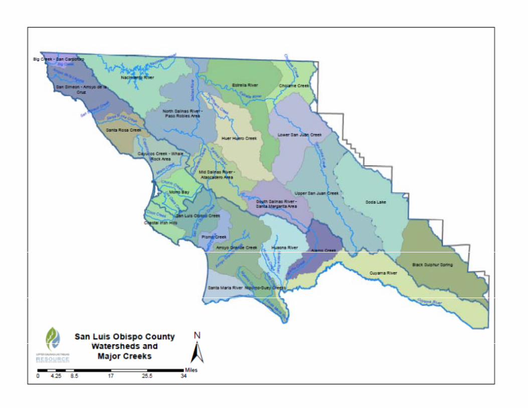
appendix a map - coastal san luis resource … a maps.pdfsan luis obispo san luis obispo county ±...

2
Kern County Santa Barbara County Monterey County Kings County Tulare County Ventura County Soda Lake Cuyama River Estrella River Nacimiento River Black Sulphur Spring Huasna River Huer Huero Creek Lower San Juan Creek Morro Bay Alamo Creek Lower Salinas - Paso Robles Creek Area Upper San Juan Creek Arroyo Grande Creek Cholame Creek San Luis Obispo Creek Santa Maria River Santa Rosa Creek Area Pismo Creek Coastal Irish Hills Upper Salinas - Santa Margarita Area Mid Salinas - Atascadero Area Nipomo-Suey Creeks San Simeon - Arroyo de la Cruz Area Cayucos Creek - Whale Rock Area Big Creek - San Carpoforo Area U S H w y 1 0 1 State Hwy 58 S t a te H w y 4 1 S t a t e Hw y 1 St a te H w y 46 U S H w y 1 0 1 State Hwy 1 St ate H w y 4 6 St a t e Hwy 4 6 Shandon Cambria Morro Bay Atascadero Paso Robles Arroyo Grande San Luis Obispo ± San Luis Obispo County Watersheds 0 8.5 17 25.5 34 4.25 Miles

Upload: hoangkhanh

Post on 02-Jul-2018

216 views

Category:

Documents


0 download

TRANSCRIPT

Kern County

Santa Barbara County

Monterey County Kings County Tulare County

Ventura County

Soda Lake

Cuyama River

Estrella RiverNacimiento River

Black Sulphur SpringHuasna River

Huer Huero CreekLower San Juan Creek

Morro Bay

Alamo Creek

Lower Salinas - PasoRobles Creek Area

Upper San Juan Creek

Arroyo Grande Creek

Cholame Creek

San Luis Obispo Creek

Santa Maria River

Santa Rosa Creek Area

Pismo CreekCoastal Irish Hills

Upper Salinas - SantaMargarita Area

Mid Salinas - AtascaderoArea

Nipomo-Suey Creeks

San Simeon - Arroyo de laCruz Area

Cayucos Creek - WhaleRock Area

Big Creek - San CarpoforoArea

US Hwy 101

State Hwy 58

State Hwy 4 1

State Hwy 1

State Hwy 46

US Hwy 101State Hwy 1

State Hwy 46

State Hwy 46 Shandon

Cambria

Morro Bay

Atascadero

Paso Robles

Arroyo Grande

San Luis Obispo

±San Luis Obispo County Watersheds

0 8.5 17 25.5 344.25Miles