amsterdam avenue 110 st to 155 st - welcome to …€¦ · amsterdam avenue 110 th st to 155 st...
TRANSCRIPT
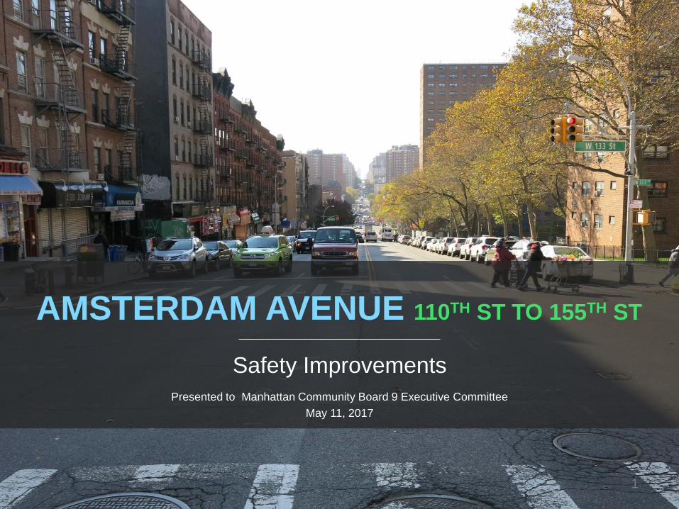
AMSTERDAM AVENUE 110TH ST TO 155TH ST
Safety Improvements
Presented to Manhattan Community Board 9 Executive Committee
May 11, 2017
1
PRESENTATION OVERVIEW
1. Background
2. Proposal
3. Summary
2
Amsterdam Avenue Safety Improvements
Background Project Location
Safety
Key Issues
Proposal Corridor Redesign
Intersection Improvements
Making It Work
Summary

1 Background
3
Background
4
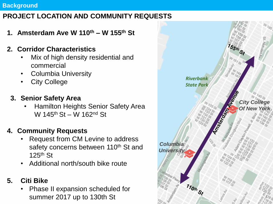
PROJECT LOCATION AND COMMUNITY REQUESTS
Amsterdam Ave 110-162
Request from CM Levine to
address 110-125 safety concerns
Response to request
Columbia University/ City College
Program Goal
Redesigns of high-crash corridors
that include bicycle facilities can
improve safety for all road users
Street safety through:
1. Public dialogue & education
2. Law enforcement
3. Street design
4. Legislation
Map with project location outlined
landmarks
Amsterdam Ave (110th St To 162nd St)
Hamilton Heights Senior Safety Area (145th – 162nd)
Community request for safety improvements
Columbia
University
Riverbank State Park
City College
Of New York
1. Amsterdam Ave W 110th – W 155th St
2. Corridor Characteristics
• Mix of high density residential and
commercial
• Columbia University
• City College
3. Senior Safety Area
• Hamilton Heights Senior Safety Area
W 145th St – W 162nd St
4. Community Requests
• Request from CM Levine to address
safety concerns between 110th St and
125th St
• Additional north/south bike route
5. Citi Bike
• Phase II expansion scheduled for
summer 2017 up to 130th St
Background
5
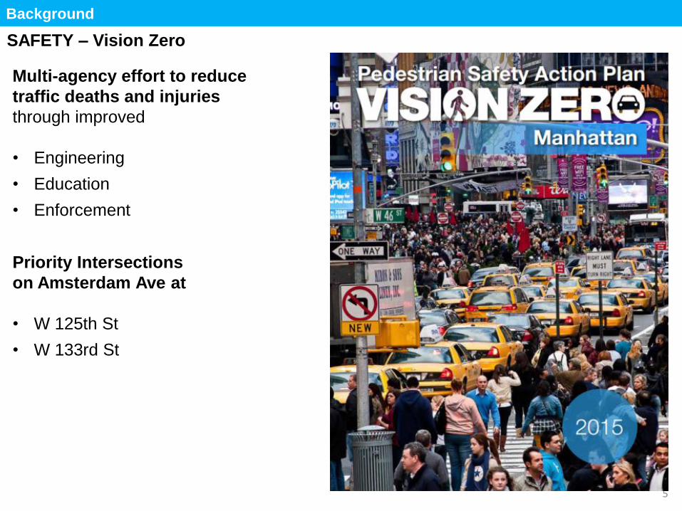
SAFETY – Vision Zero
Multi-agency effort to reduce
traffic deaths and injuries
through improved
• Engineering
• Education
• Enforcement
Priority Intersections
on Amsterdam Ave at
• W 125th St
• W 133rd St
Program Goal
Redesigns of high-crash corridors
that include bicycle facilities can
improve safety for all road users
Enhance street safety through:
1. Public dialogue & education
2. Law enforcement
3. Street design
4. Legislation
Total
Injuries
Severe
Injuries Fatalities KSI
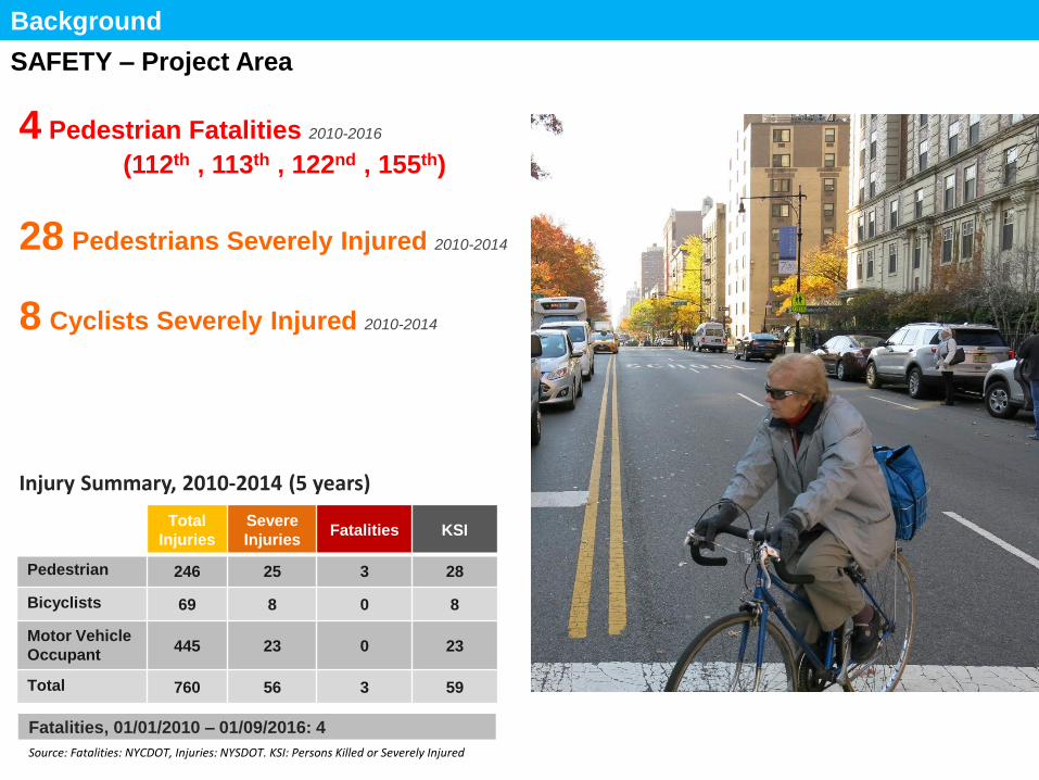
Pedestrian 246 25 3 28
Bicyclists 69 8 0 8
Motor Vehicle
Occupant 445 23 0 23
Total 760 56 3 59
Fatalities, 01/01/2010 – 01/09/2016: 4
Source: Fatalities: NYCDOT, Injuries: NYSDOT. KSI: Persons Killed or Severely Injured
SAFETY – Project Area
Injury Summary, 2010-2014 (5 years)
Background
These are the numbers *CALL OUT*
4 PED DEATHS
27 SEV INJURED
7 CYCLISTS SEV
**COLORED BOXES**
4 Pedestrian Fatalities
27 Pedestrians
Severely Injured
7 Cyclists
Severely Injured
4 Pedestrian Fatalities 2010-2016
(112th , 113th , 122nd , 155th)
28 Pedestrians Severely Injured 2010-2014
8 Cyclists Severely Injured 2010-2014
Amsterdam Looking North at West 112th
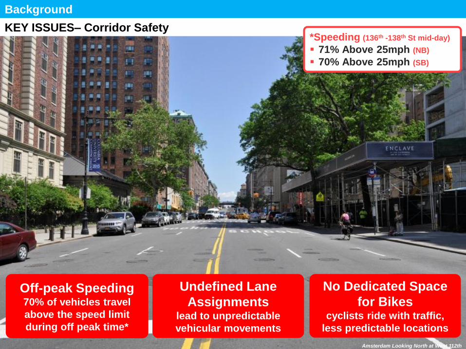
KEY ISSUES– Corridor Safety
Background
Wide Street
Speeding
Long Crossings
Poorly aligned
Intersections
Poorly Aligned
Intersections at
Major Cross Streets Poor Sightlines
Due to Grade
Change
Wide Street
creates long
pedestrian
crossings
Speeding/
Unpredictable
Vehicle
Movements
*Speeding (136th -138th St mid-day)
71% Above 25mph (NB)
70% Above 25mph (SB)
Speeding/
Unpredictable
Vehicle
Movements
Undefined Lane
Assignments lead to unpredictable
vehicular movements
Off-peak Speeding 70% of vehicles travel
above the speed limit
during off peak time*
No Dedicated Space
for Bikes cyclists ride with traffic,
less predictable locations
New roadway
configuration to
feature one lane in
each direction
Amsterdam Looking West at West 133rd
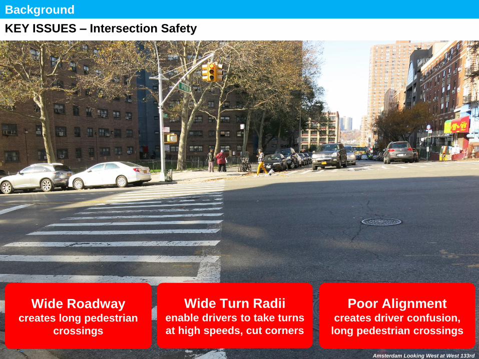
KEY ISSUES – Intersection Safety
Background
Wide Street
Speeding
Long Crossings
Poorly aligned
Intersections
Poorly Aligned
Intersections at
Major Cross Streets Poor Sightlines
Due to Grade
Change
Wide Street
creates long
pedestrian
crossings
Speeding/
Unpredictable
Vehicle
Movements
Speeding (136th -138th St):
71% Above 25mph (NB)
70% Above 25mph (SB)
Speeding/
Unpredictable
Vehicle
Movements
Poor Alignment creates driver confusion,
long pedestrian crossings
Wide Roadway creates long pedestrian
crossings
Wide Turn Radii enable drivers to take turns
at high speeds, cut corners
Amsterdam Looking North at West 112th
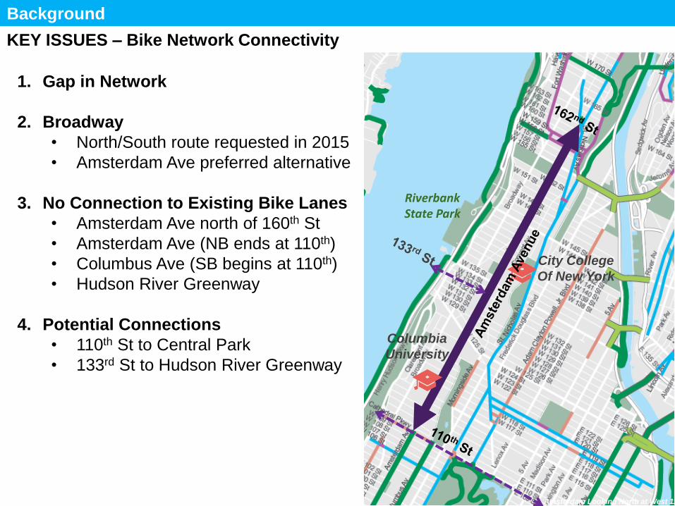
KEY ISSUES – Bike Network Connectivity
Background
Wide Street
Speeding
Long Crossings
Poorly aligned
Intersections
Poorly Aligned
Intersections at
Major Cross Streets Poor Sightlines
Due to Grade
Change
Wide Street
creates long
pedestrian
crossings
Speeding/
Unpredictable
Vehicle
Movements
Speeding (136th -138th St):
71% Above 25mph (NB)
70% Above 25mph (SB)
Speeding/
Unpredictable
Vehicle
Movements
Wide Roadway creates long pedestrian
crossings
9
Columbia
University
Riverbank State Park
City College
Of New York
1. Gap in Network
2. Broadway
• North/South route requested in 2015
• Amsterdam Ave preferred alternative
3. No Connection to Existing Bike Lanes
• Amsterdam Ave north of 160th St
• Amsterdam Ave (NB ends at 110th)
• Columbus Ave (SB begins at 110th)
• Hudson River Greenway
4. Potential Connections
• 110th St to Central Park
• 133rd St to Hudson River Greenway
3 Amsterdam Ave
Proposal
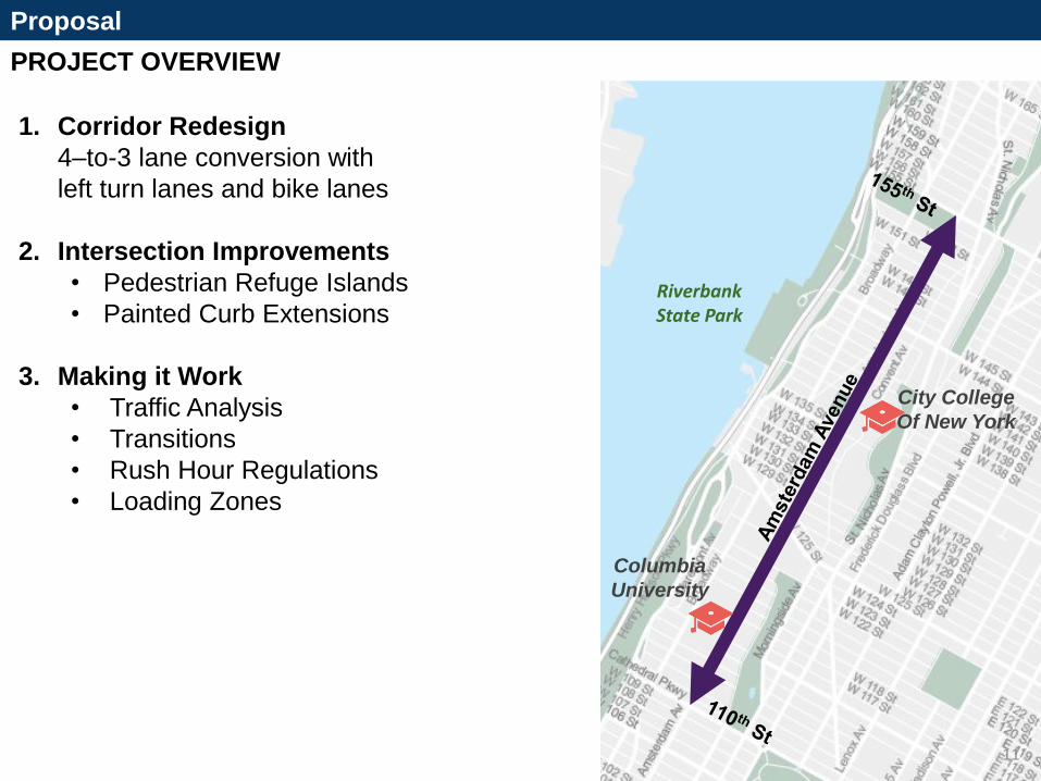
PROJECT OVERVIEW
Proposal
1. Corridor Redesign
4–to-3 lane conversion with
left turn lanes and bike lanes
2. Intersection Improvements
• Pedestrian Refuge Islands
• Painted Curb Extensions
3. Making it Work
• Traffic Analysis
• Transitions
• Rush Hour Regulations
• Loading Zones
11
Columbia
University
Riverbank State Park
City College
Of New York
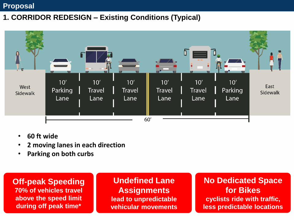
1. CORRIDOR REDESIGN – Existing Conditions (Typical)
Proposal
• Corridor Redesign: 4–to-3 lane conversion with left turn lanes and bike lanes
CROSS SECTION SHOWING TYPICAL 4-3
• 60 ft wide • 2 moving lanes in each direction • Parking on both curbs
No Dedicated Space
for Bikes cyclists ride with traffic,
less predictable locations
Undefined Lane
Assignments lead to unpredictable
vehicular movements
Off-peak Speeding 70% of vehicles travel
above the speed limit
during off peak time*
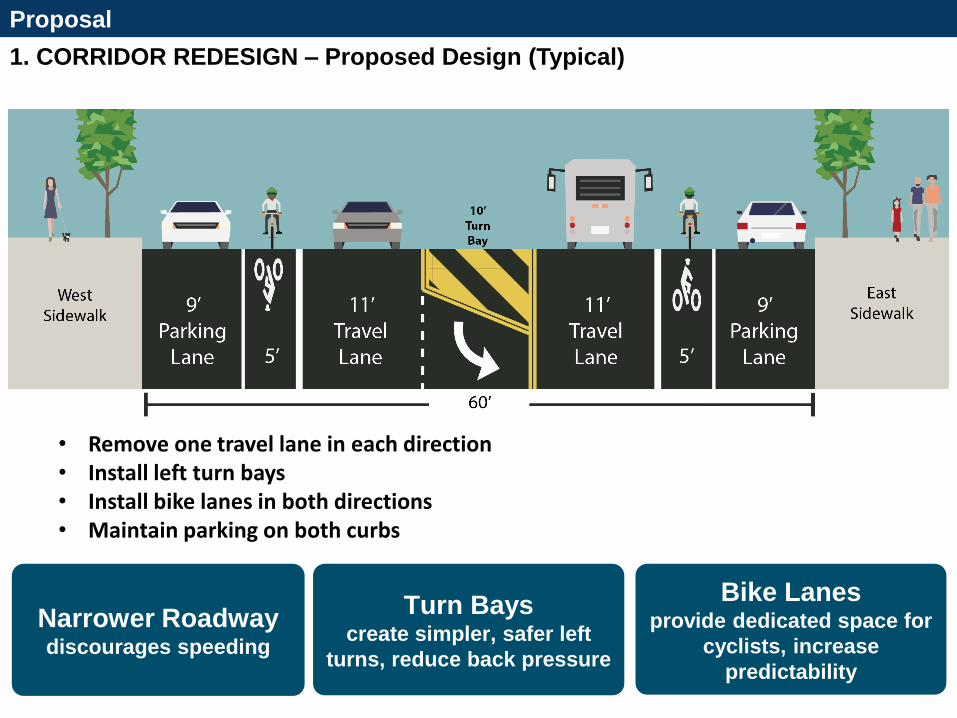
1. CORRIDOR REDESIGN – Proposed Design (Typical)
Proposal
• Corridor Redesign: 4–to-3 lane conversion with left turn lanes and bike lanes
Install left turns
bays at cross
streets
XXXX
New roadway
configuration to
feature one lane in
each direction
Install high
visibility
crosswalk
• Remove one travel lane in each direction • Install left turn bays • Install bike lanes in both directions • Maintain parking on both curbs
Turn Bays
create simpler, safer left
turns, reduce back pressure
Narrower Roadway discourages speeding
Bike Lanes provide dedicated space for
cyclists, increase
predictability
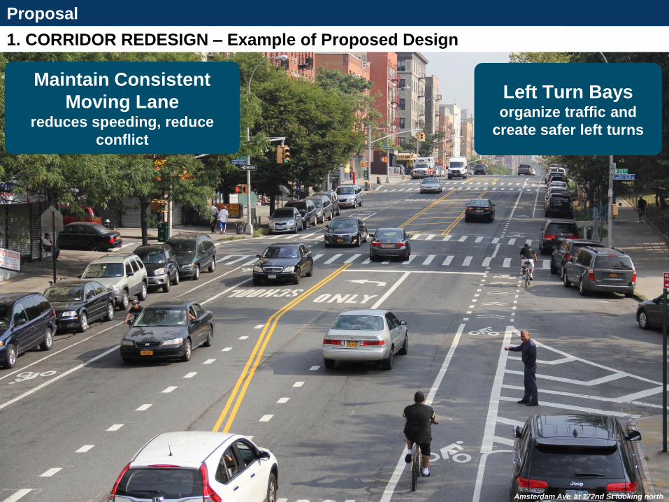
1. CORRIDOR REDESIGN – Example of Proposed Design
Proposal
• Corridor Redesign: 4–to-3 lane conversion with left turn lanes and bike lanes
Left Turn Bays organize traffic and
create safer left turns
Maintain Consistent
Moving Lane reduces speeding, reduce
conflict
Amsterdam Ave at 172nd St looking north
Left turning motorists feel back pressure from vehicles wanting to go through while trying to: • Identify gap in two lanes,
poor visibility for second lane
• Look for pedestrians in crosswalk
Motorists traveling thru get stuck behind left turning vehicles and weave or merge into right lane
Left turning motorists feel less back pressure because: • No thru motorists are
stuck behind them
• Only have to look for gap in one lane of motor vehicle traffic
• Easier to focus on pedestrians in crosswalk
Motorists traveling thru are already in correct position, results in less weaving and merging improves safety and traffic flow Motorists turn less aggressively, reducing risk of injury for all road users
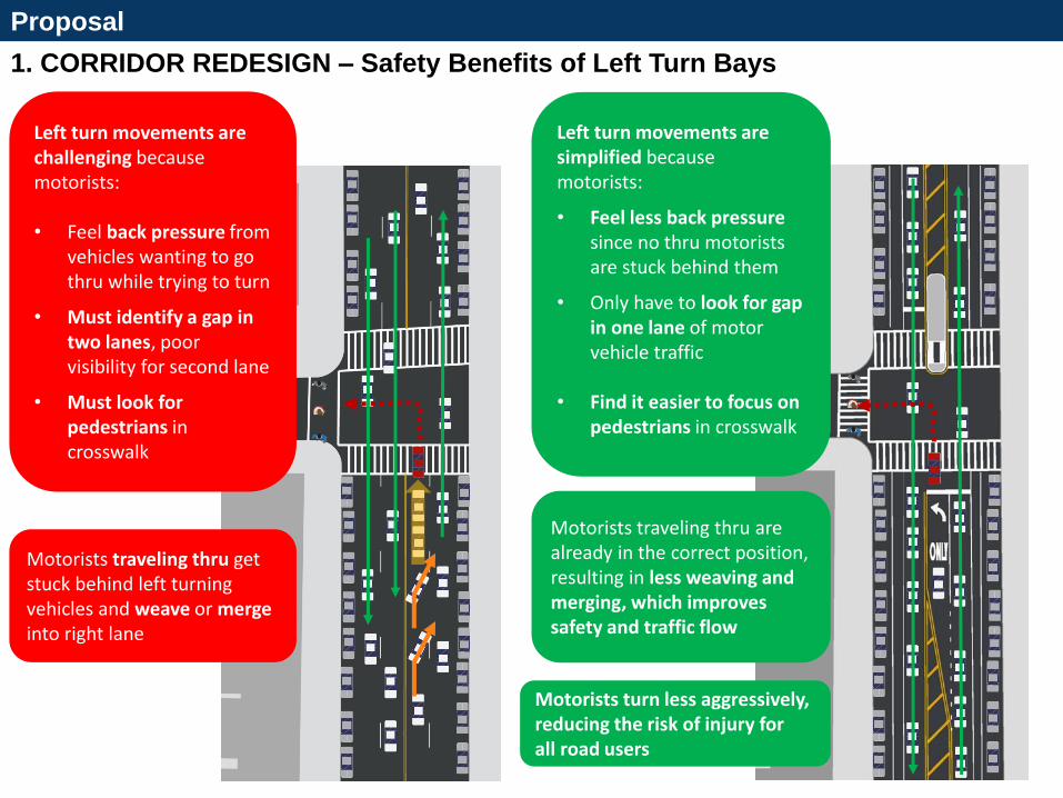
1. CORRIDOR REDESIGN – Safety Benefits of Left Turn Bays
Proposal
Motorists traveling thru get stuck behind left turning vehicles and weave or merge into right lane
Left turn movements are challenging because motorists: • Feel back pressure from
vehicles wanting to go thru while trying to turn
• Must identify a gap in two lanes, poor visibility for second lane
• Must look for pedestrians in crosswalk
Left turn movements are simplified because motorists:
• Feel less back pressure since no thru motorists are stuck behind them
• Only have to look for gap in one lane of motor vehicle traffic
• Find it easier to focus on pedestrians in crosswalk
Motorists traveling thru are already in the correct position, resulting in less weaving and merging, which improves safety and traffic flow
Motorists turn less aggressively, reducing the risk of injury for all road users
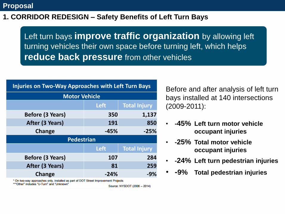
1. CORRIDOR REDESIGN – Safety Benefits of Left Turn Bays
Proposal
• Corridor Redesign: 4–to-3 lane conversion with left turn lanes and bike lanes
Before and after analysis of left turn
bays installed at 140 intersections
(2009-2011):
• -45% Left turn motor vehicle
occupant injuries
• -25% Total motor vehicle
occupant injuries
• -24% Left turn pedestrian injuries
• -9% Total pedestrian injuries
Injuries on Two-Way Approaches with Left Turn Bays
Motor Vehicle
Left Total Injury
Before (3 Years) 350 1,137
After (3 Years) 191 850
Change -45% -25%
Pedestrian
Left Total Injury
Before (3 Years) 107 284
After (3 Years) 81 259
Change -24% -9%
Left turn bays improve traffic organization by allowing left turning
vehicles their own space before turning left, which helps reduce back
pressure from other vehicles
Left turn bays improve traffic organization by allowing left
turning vehicles their own space before turning left, which helps
reduce back pressure from other vehicles
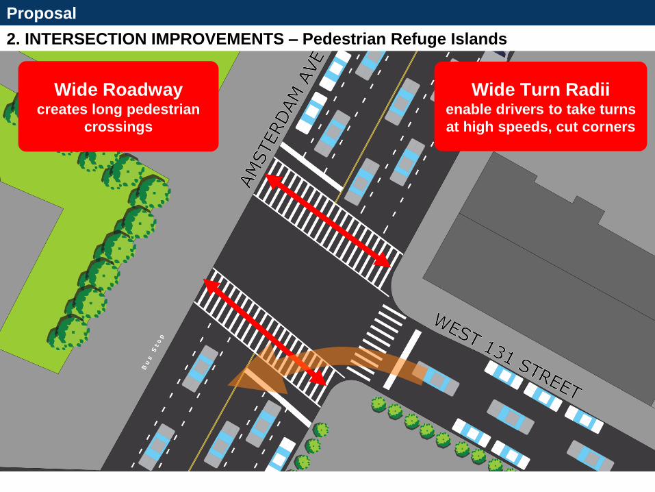
2. INTERSECTION IMPROVEMENTS – Pedestrian Refuge Islands
Proposal
• Pedestrian Refuge Islands at Targeted Intersections
Wide Roadway creates long pedestrian
crossings
Wide Turn Radii enable drivers to take turns
at high speeds, cut corners
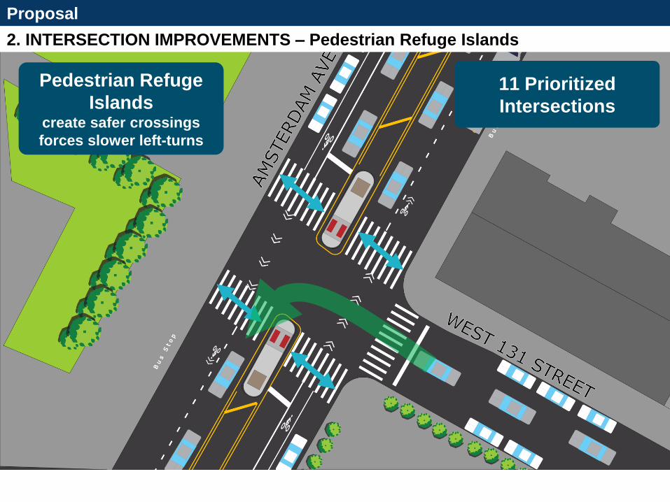
2. INTERSECTION IMPROVEMENTS – Pedestrian Refuge Islands
Proposal
• Pedestrian Refuge Islands at Targeted Intersections
Pedestrian Refuge
Islands create safer crossings
forces slower left-turns
11 Prioritized
Intersections

Proposal
Vanderbilt Ave, BK 2. INTERSECTION IMPROVEMENTS – Example of Pedestrian Refuge Islands
Vanderbilt Ave, Brooklyn looking north
Proposal
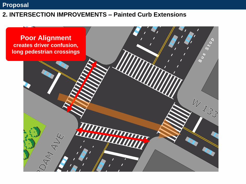
2. INTERSECTION IMPROVEMENTS – Painted Curb Extensions
X-section of curb extension @ 133
1. Intersection Improvements
• Pedestrian Refuge Islands
Poor Alignment creates driver confusion,
long pedestrian crossings
Proposal
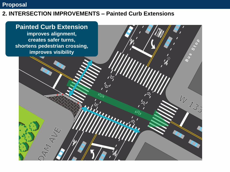
2. INTERSECTION IMPROVEMENTS – Painted Curb Extensions
X-section of curb extension @ 133
Highlight improvements Painted Curb Extension
improves alignment,
creates safer turns,
shortens pedestrian crossing,
improves visibility
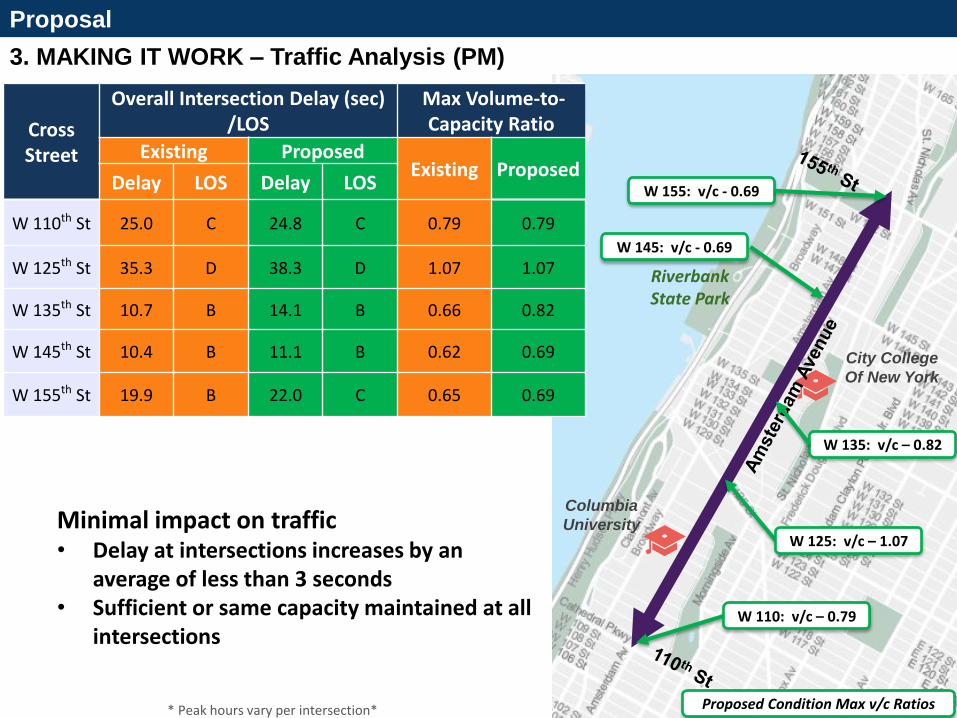
3. MAKING IT WORK – Traffic Analysis (PM)
Proposal
22
Columbia
University
Riverbank State Park
City College
Of New York
* Peak hours vary per intersection*
W 110: v/c – 0.79
Proposed Condition Max v/c Ratios
W 125: v/c – 1.07
W 135: v/c – 0.82
W 145: v/c - 0.69
W 155: v/c - 0.69
Cross Street
Overall Intersection Delay (sec) /LOS
Max Volume-to- Capacity Ratio
Existing Proposed Existing Proposed
Delay LOS Delay LOS
W 110th St 25.0 C 24.8 C 0.79 0.79
W 125th St 35.3 D 38.3 D 1.07 1.07
W 135th St 10.7 B 14.1 B 0.66 0.82
W 145th St 10.4 B 11.1 B 0.62 0.69
W 155th St 19.9 B 22.0 C 0.65 0.69
Minimal impact on traffic • Delay at intersections increases by an
average of less than 3 seconds • Sufficient or same capacity maintained at all
intersections
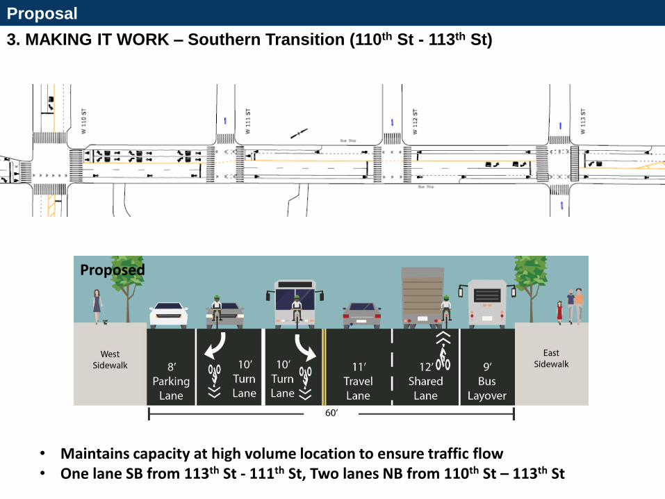
3. MAKING IT WORK – Southern Transition (110th St - 113th St)
Proposal
• Maintains capacity at high volume location to ensure traffic flow • One lane SB from 113th St - 111th St, Two lanes NB from 110th St – 113th St
Proposed
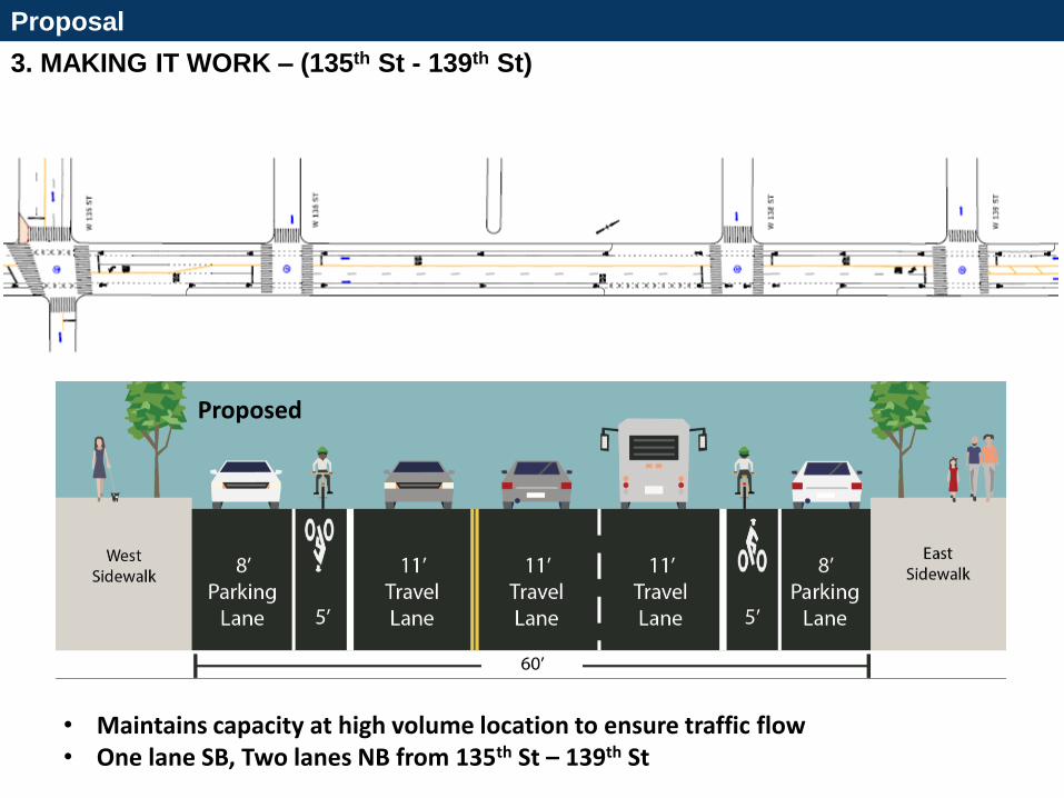
3. MAKING IT WORK – (135th St - 139th St)
Proposal
• Maintains capacity at high volume location to ensure traffic flow • One lane SB, Two lanes NB from 135th St – 139th St
Proposed
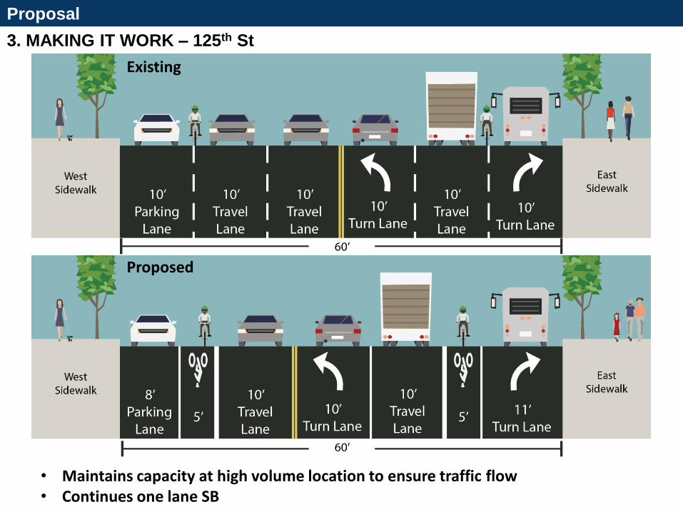
3. MAKING IT WORK – 125th St
Proposal
• Maintains capacity at high volume location to ensure traffic flow • Continues one lane SB
Existing
Proposed
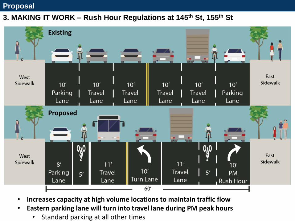
3. MAKING IT WORK – Rush Hour Regulations at 145th St, 155th St
Proposal
CROSS SECTION SHOWING TYPICAL 4-3
• Increases capacity at high volume locations to maintain traffic flow • Eastern parking lane will turn into travel lane during PM peak hours
• Standard parking at all other times
Existing
Proposed
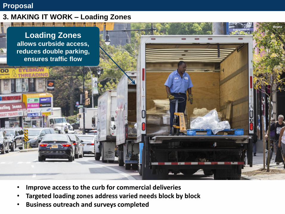
3. MAKING IT WORK – Loading Zones
Proposal
Indicates a combination of open metered parking and metered commercial
Indicates metered commercial 7am-7pm Monday to Friday
Note 1: Metered parking to remain unless otherwise indicated. Note 2: Specifics of regulations north of W 106th St pending further consultation with the Columbus Amsterdam BID
• Improve access to the curb for commercial deliveries • Targeted loading zones address varied needs block by block • Business outreach and surveys completed
Loading Zones allows curbside access,
reduces double parking,
ensures traffic flow
Bronx
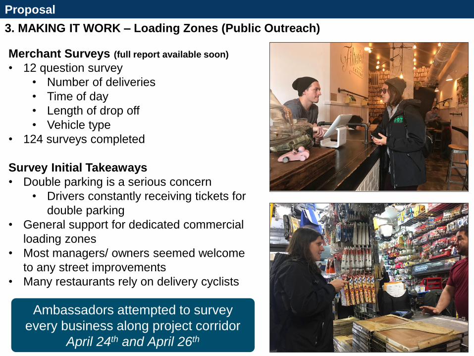
3. MAKING IT WORK – Loading Zones (Public Outreach)
Proposal
Indicates a combination of open metered parking and metered commercial
Indicates metered commercial 7am-7pm Monday to Friday
Note 1: Metered parking to remain unless otherwise indicated. Note 2: Specifics of regulations north of W 106th St pending further consultation with the Columbus Amsterdam BID
• Improve access to the curb for commercial deliveries • Targeted loading zones address varied needs block by block • Business outreach and surveys scheduled
Loading Zones allows curbside access,
reduces double parking,
ensures traffic flow
Bronx
Merchant Surveys (full report available soon)
• 12 question survey
• Number of deliveries
• Time of day
• Length of drop off
• Vehicle type
• 124 surveys completed
Survey Initial Takeaways
• Double parking is a serious concern
• Drivers constantly receiving tickets for
double parking
• General support for dedicated commercial
loading zones
• Most managers/ owners seemed welcome
to any street improvements
• Many restaurants rely on delivery cyclists
Ambassadors attempted to survey
every business along project corridor
April 24th and April 26th

3 SUMMARY
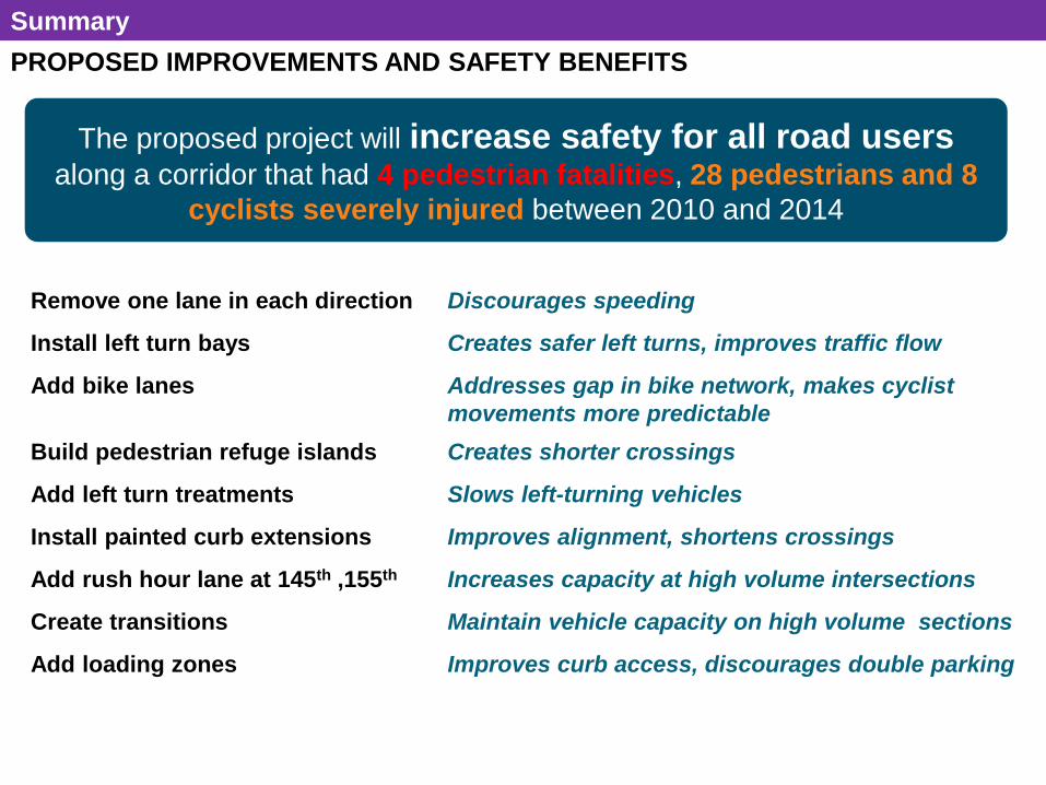
PROPOSED IMPROVEMENTS AND SAFETY BENEFITS
Summary
1. Removal of one travel lane in each
direction
2. No Connection to Existing Bike Lanes
• Amsterdam Ave north of 162nd St
• Amsterdam Ave (NB ends at 110th)
• Columbus Ave (SB begins at 110th)
3. Limited NB/SB Routes
• Hudson River Greenway and St
Nicholas Ave separated by long
distance and significant topography
4. Limited Access to Hudson River
Greenway and High Bridge Park
Remove one lane in each direction Discourages speeding
Install left turn bays Creates safer left turns, improves traffic flow
Add bike lanes Addresses gap in bike network, makes cyclist
movements more predictable
Build pedestrian refuge islands Creates shorter crossings
Add left turn treatments Slows left-turning vehicles
Install painted curb extensions Improves alignment, shortens crossings
Add rush hour lane at 145th ,155th Increases capacity at high volume intersections
Create transitions Maintain vehicle capacity on high volume sections
Add loading zones Improves curb access, discourages double parking
The proposed project will increase safety for all road users along a corridor that had 4 pedestrian fatalities, 28 pedestrians and 8
cyclists severely injured between 2010 and 2014
nyc.gov/dot
Questions?
THANK YOU!
31
NYCDOT nyc_dot nyc_dot NYCDOT
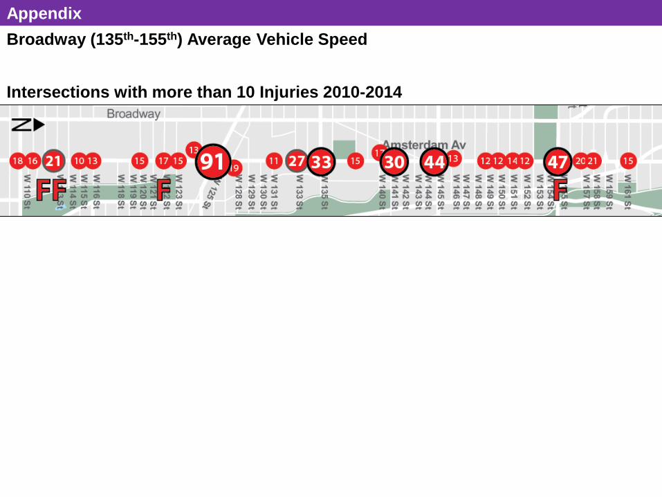
Broadway (135th-155th) Average Vehicle Speed
33
Columbia
University
Riverbank State Park
City College
Of New York
* Peak hours vary per intersection*
W 110: v/c – 0.79
Proposed Condition Max v/c Ratios
W 125: v/c – 1.07
W 135: v/c – 0.82
W 145: v/c - 0.69
W 155: v/c - 0.69
W 162: v/c – 0.74 Cross Street
Overall Intersection Delay (sec) /LOS
Max Volume-to- Capacity Ratio
Existing Proposed Existing Proposed
Delay LOS Delay LOS
W 110th St 25.5 C 25.3 C 0.79 0.79
W 125th St 35.3 D 38.3 D 1.07 1.07
W 135th St 9.2 A 19.4 B 0.66 0.82
W 145th St 10.3 B 14.0 B 0.62 0.69
W 155th St 22.2 C 19.0 B 0.65 0.69
W 162nd St 22.4 C 24.7 C 0.74 0.74
• Left turn bays organize traffic • Minimal impact on traffic • Maintains capacity at high volume locations
to ensure traffic flow
Appendix
Intersections with more than 10 Injuries 2010-2014