alfred wegener & continental drift dark brown = evidence of one connected
TRANSCRIPT
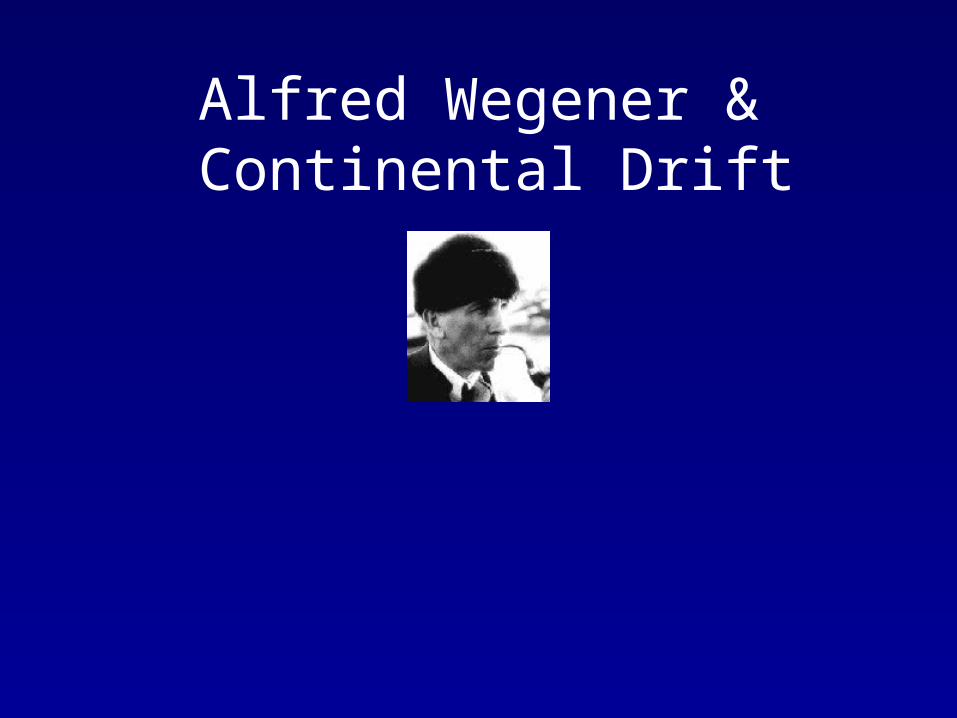
Alfred Wegener & Continental Drift
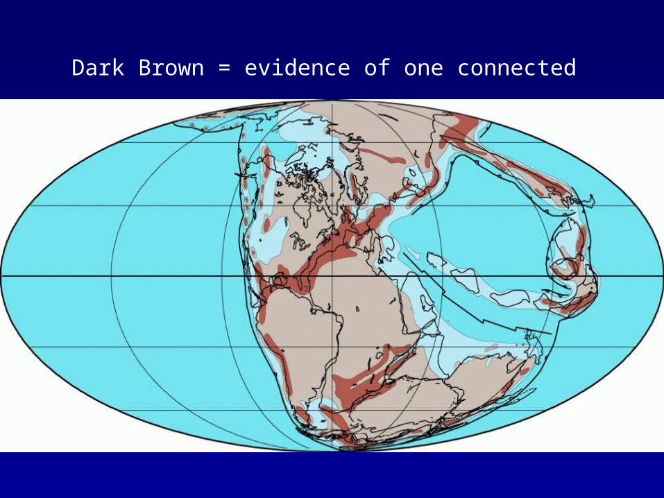
Dark Brown = evidence of one connected
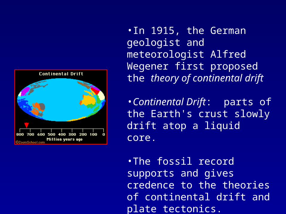
•In 1915, the German geologist and meteorologist Alfred Wegener first proposed the theory of continental drift
•Continental Drift: parts of the Earth's crust slowly drift atop a liquid core.
•The fossil record supports and gives credence to the theories of continental drift and plate tectonics.
Breakup of Pangaea
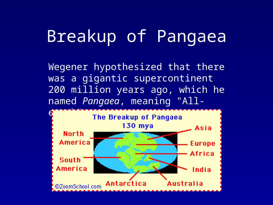
Wegener hypothesized that there was a gigantic supercontinent 200 million years ago, which he named Pangaea, meaning "All-earth".
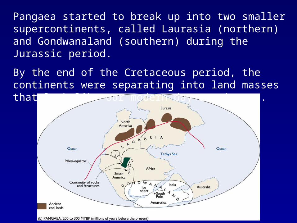
Pangaea started to break up into two smaller supercontinents, called Laurasia (northern) and Gondwanaland (southern) during the Jurassic period.
By the end of the Cretaceous period, the continents were separating into land masses that look like our modern-day continents.
Evidence• Puzzle fit of continents
• Fossils in SA are same as those in Africa, fossilized tropical plants in Antarctica.
• Evidence of same glacier erosion in Southern Africa, Australia, India
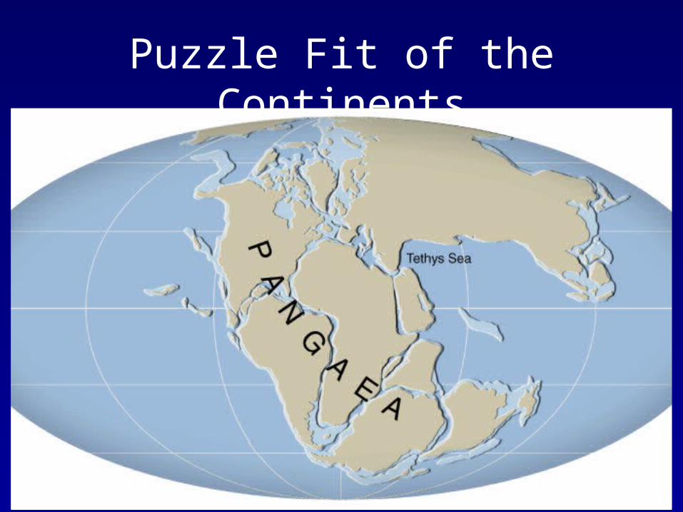
Puzzle Fit of the Continents
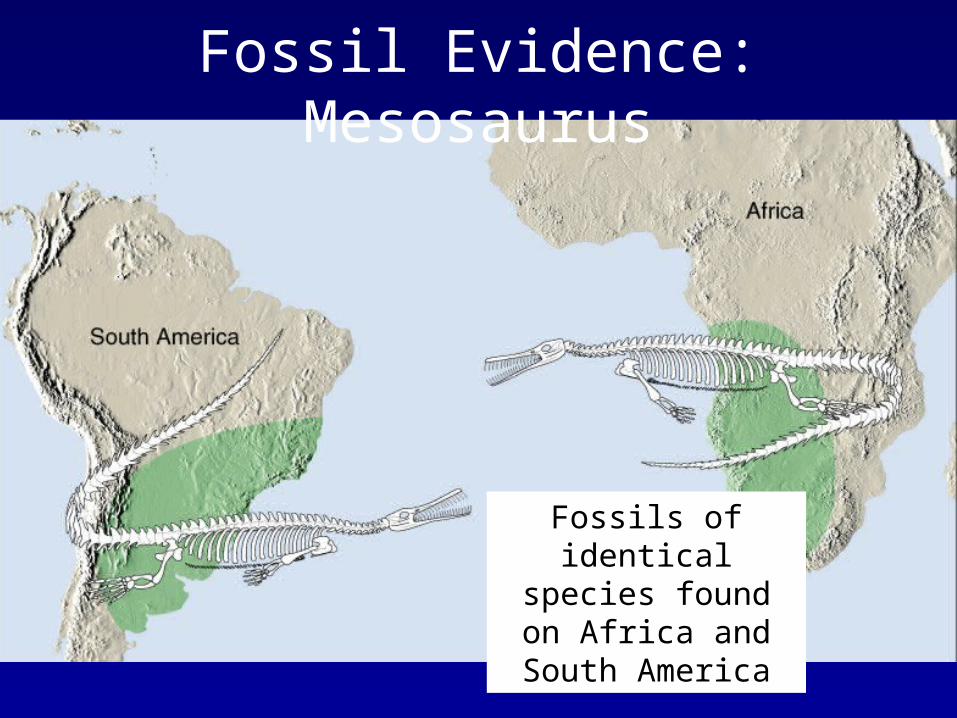
Fossil Evidence: Mesosaurus
Fossils of identical species found on Africa and South
America
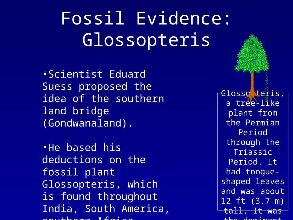
Fossil Evidence: Glossopteris
•Scientist Eduard Suess proposed the idea of the southern land bridge (Gondwanaland).
•He based his deductions on the fossil plant Glossopteris, which is found throughout India, South America, southern Africa, Australia, and Antarctica
Glossopteris, a
tree-like plant from the Permian Period
through the Triassic Period. It had tongue-shaped
leaves and was about 12 ft (3.7 m)
tall. It was the dominant plant of
Gondwana.
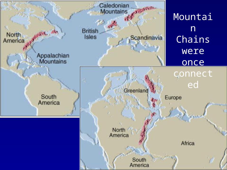
Mountain Chains
were once connected
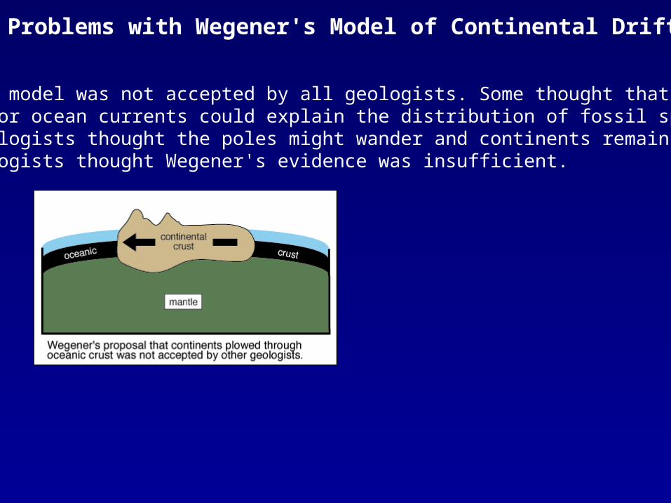
Wegener's model was not accepted by all geologists. Some thought that dispersionby winds or ocean currents could explain the distribution of fossil species. Other geologists thought the poles might wander and continents remain stationary. Many geologists thought Wegener's evidence was insufficient.
Problems with Wegener's Model of Continental Drift
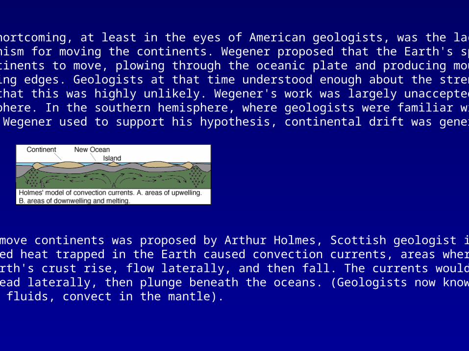
The greatest shortcoming, at least in the eyes of American geologists, was the lack of an adequate mechanism for moving the continents. Wegener proposed that the Earth's spin caused the continents to move, plowing through the oceanic plate and producing mountains on their leading edges. Geologists at that time understood enough about the strength of rocks to know that this was highly unlikely. Wegener's work was largely unaccepted in the northern hemisphere. In the southern hemisphere, where geologists were familiar with the rocks that Wegener used to support his hypothesis, continental drift was generally accepted.
A mechanism to move continents was proposed by Arthur Holmes, Scottish geologist in 1928. He believed heat trapped in the Earth caused convection currents, areas where fluids beneath the Earth's crust rise, flow laterally, and then fall. The currents would rise beneath continents, spread laterally, then plunge beneath the oceans. (Geologists now know that solid rock, not fluids, convect in the mantle).
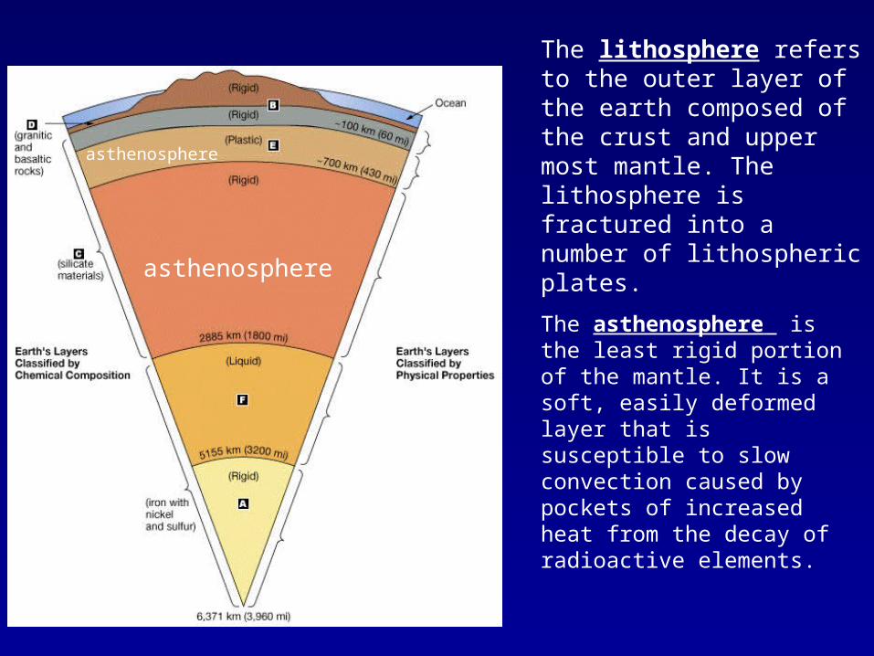
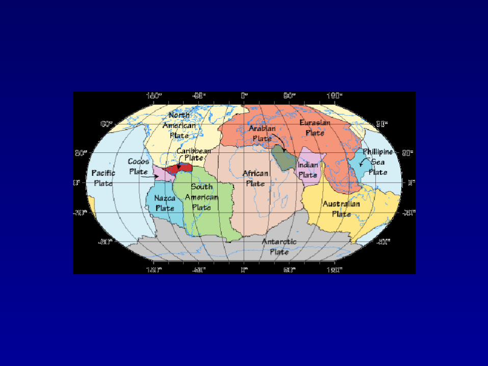
The lithosphere refers to the outer layer of the earth composed of the crust and upper most mantle. The lithosphere is fractured into a number of lithospheric plates.
The asthenosphere is the least rigid portion of the mantle. It is a soft, easily deformed layer that is susceptible to slow convection caused by pockets of increased heat from the decay of radioactive elements.
asthenosphere
asthenosphere
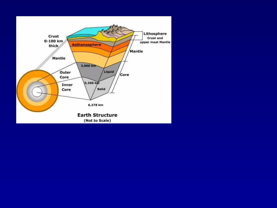
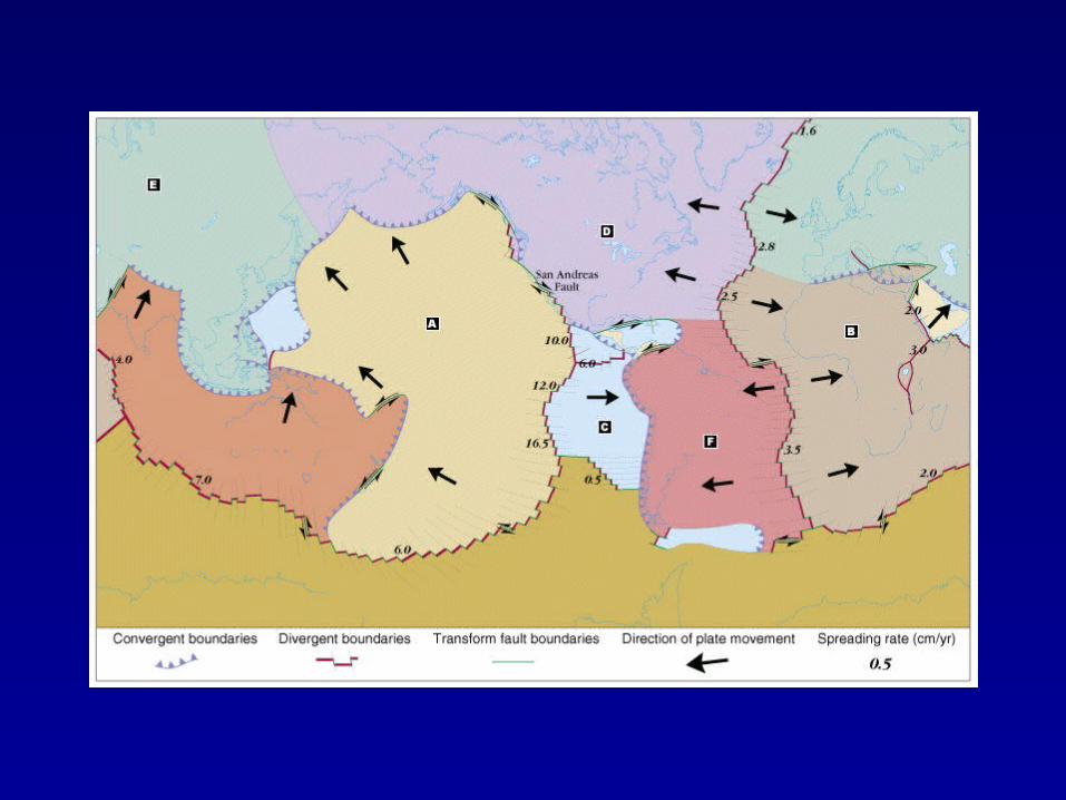
Plate Movement• Gravity: Oceanic lithosphere thickens as it moves away from a spreading centre and cools, a
configuration which might tend to induce plates to slide under the force of gravity, from a divergent margin towards a convergent margin.
– Since the plates are slightly denser than the underlying asthenosphere, they tend to sink. This sinking action is known as slab-pull because the sinking plate edge pulls the remainder of the plate behind it.
• Descending plates: This hypothesis suggests that a cold dense plate descending into the mantle at a subduction zone may pull the rest of the plate with it and thus cause plate motion.
• Convection: the movement of molten material circulating deep within the earth.
– A convection current occurs when hot, molten, rocky material floats up within the asthenosphere, then cools as it approaches the surface. As it cools, the material becomes denser and begins to sink again, moving in a circular pattern.
• Thermal Plumes: vertical columns of molten material that rise up through the
asthenosphere and appear on the surface of the earth as hot spots. (more associated with Island formation than plate movement)
• Magma Injection This hypothesis invokes the injection of magma at a spreading centre
pushing plates apart and thereby causing plate movement.
Plate Movement (older outdated)• Centrifugal Force: The spinning of the earth is the force which moves the plates.
Alfred Wegener proposed this “engine theory”
• Lunar Pull: This hypothesis suggests that the moons influence on the oceans also influences the
movement of the plates. The movement of water is a huge force, and therefore could cause plates to move as well
• Myths - …
– Catfish
– Others?
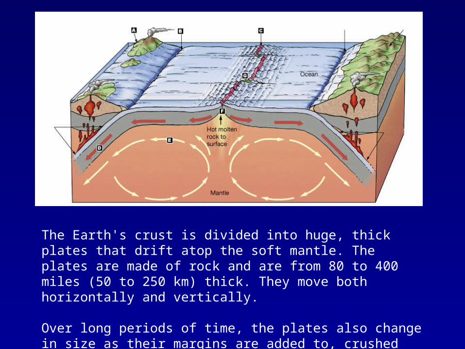
The Earth's crust is divided into huge, thick plates that drift atop the soft mantle. The plates are made of rock and are from 80 to 400 miles (50 to 250 km) thick. They move both horizontally and vertically.
Over long periods of time, the plates also change in size as their margins are added to, crushed together, or pushed back into the Earth's mantle.
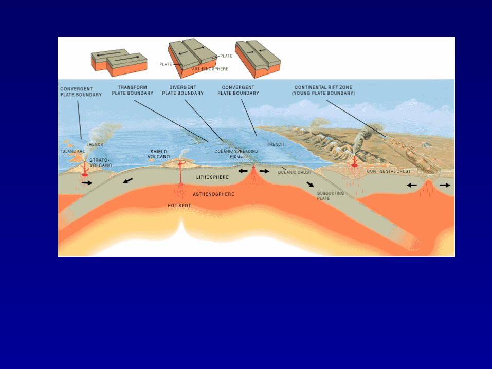
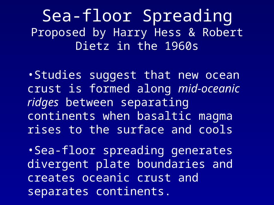
•Studies suggest that new ocean crust is formed along mid-oceanic ridges between separating continents when basaltic magma rises to the surface and cools
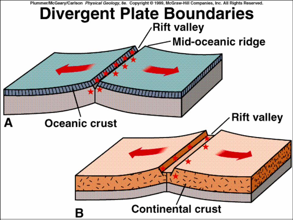
•Sea-floor spreading generates divergent plate boundaries and creates oceanic crust and separates continents.
Sea-floor SpreadingProposed by Harry Hess & Robert Dietz in the 1960s
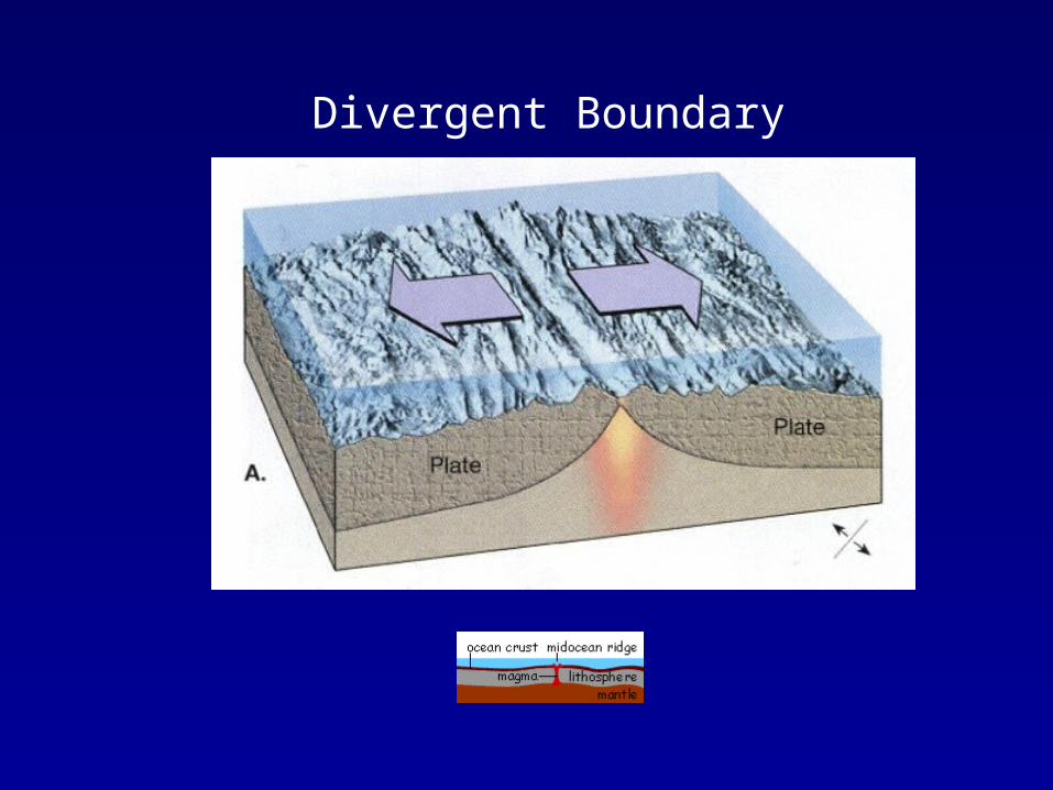
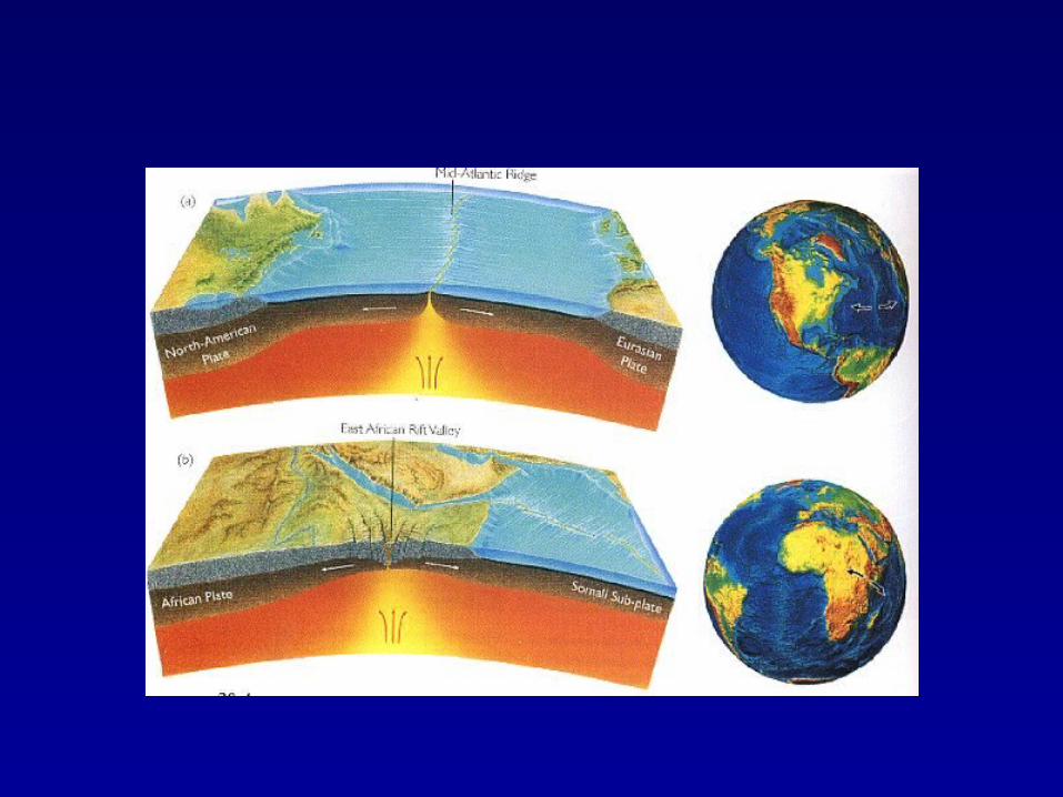
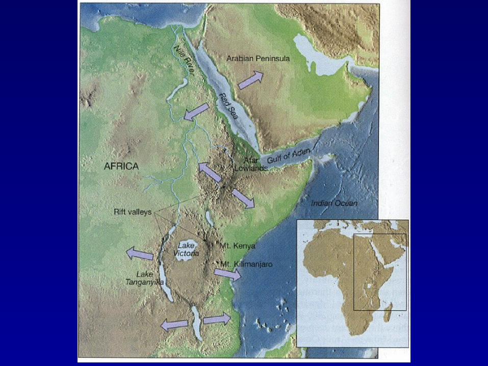
Divergent Boundary
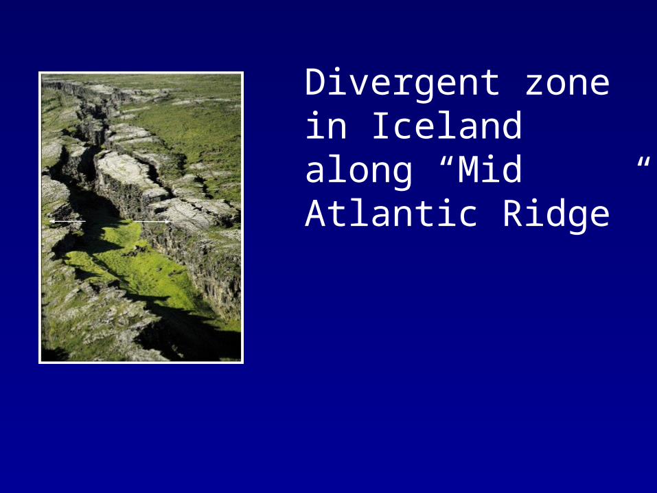
Divergent zone in Iceland along “Mid Atlantic Ridge”
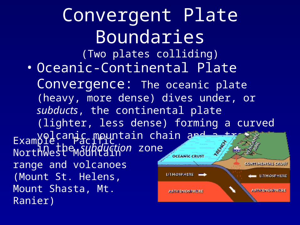
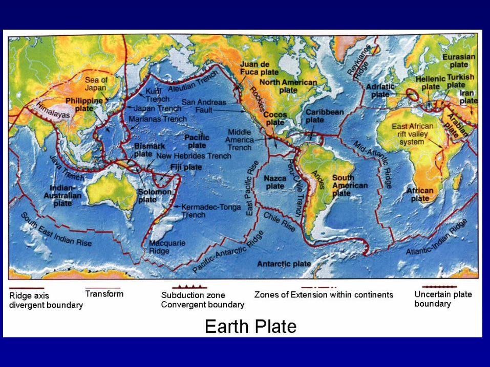
Convergent Plate Boundaries(Two plates colliding)
• Oceanic-Continental Plate Convergence: The oceanic plate (heavy, more dense) dives under, or subducts, the continental plate (lighter, less dense) forming a curved volcanic mountain chain and a trench in the subduction zone
Example: Pacific Northwest Mountain range and volcanoes (Mount St. Helens, Mount Shasta, Mt. Ranier)
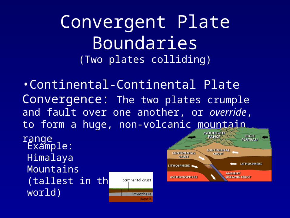
Convergent Plate Boundaries(Two plates colliding)
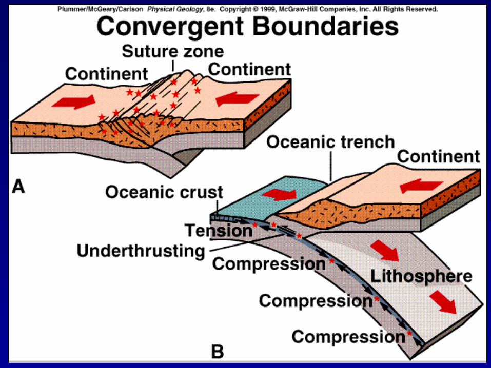
•Continental-Continental Plate Convergence: The two plates crumple and fault over one another, or override,
to form a huge, non-volcanic mountain range
Example: Himalaya Mountains (tallest in the world)
Convergent Plate Boundaries(Two plates colliding)
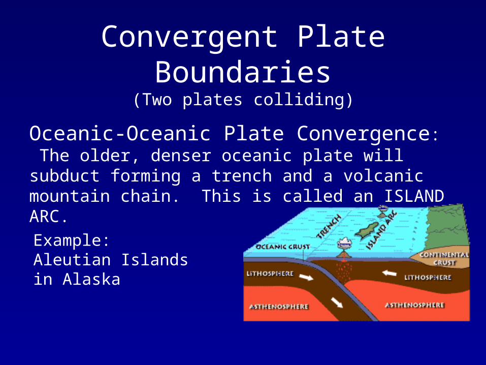
Oceanic-Oceanic Plate Convergence: The older, denser oceanic plate will subduct forming a trench and a volcanic mountain chain. This is called an ISLAND ARC.
Example: Aleutian Islands in Alaska
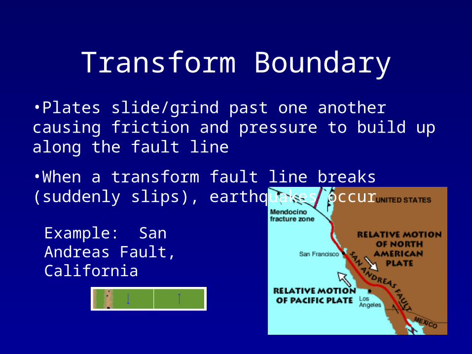
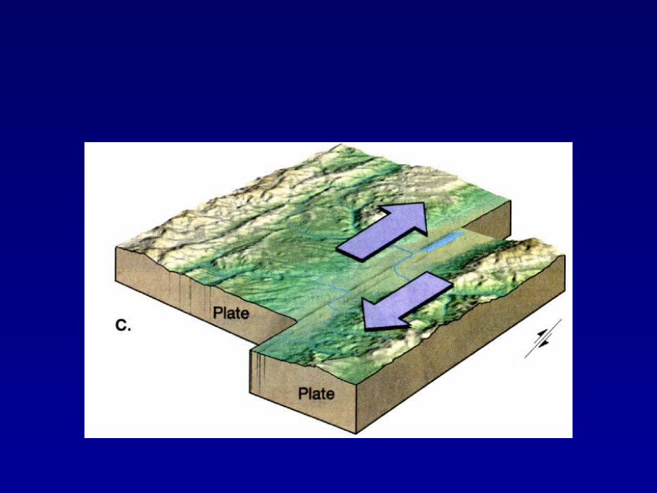
Transform Boundary•Plates slide/grind past one another causing friction and pressure to build up along the fault line
•When a transform fault line breaks (suddenly slips), earthquakes occur
Example: San Andreas Fault, California
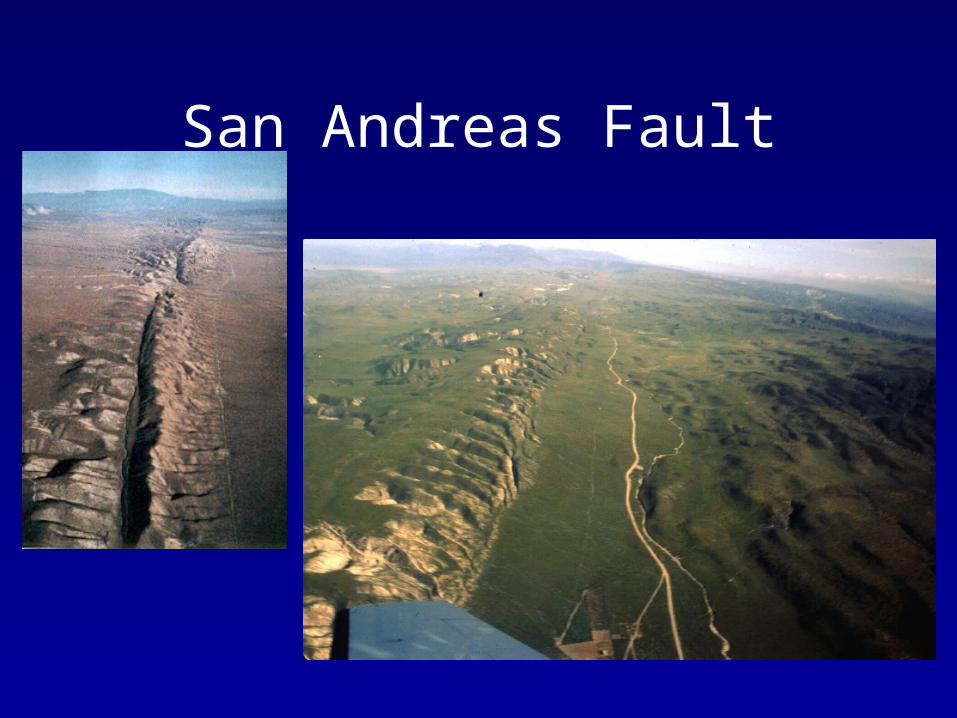
San Andreas Fault
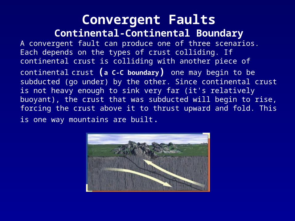
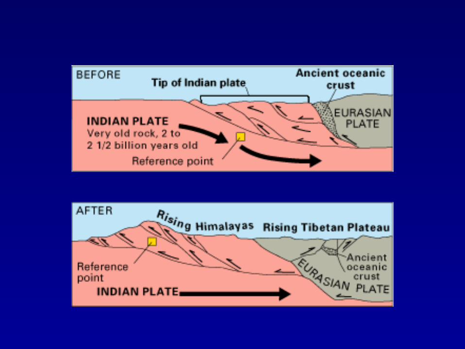
Convergent FaultsContinental-Continental Boundary
A convergent fault can produce one of three scenarios. Each depends on the types of crust colliding. If continental crust is colliding with another piece of continental crust
(a C-C boundary) one may begin to be subducted (go under) by the other. Since continental crust is not heavy enough to sink very far (it's relatively buoyant), the crust that was subducted will begin to rise, forcing the crust above it to thrust upward and
fold. This is one way mountains are built.
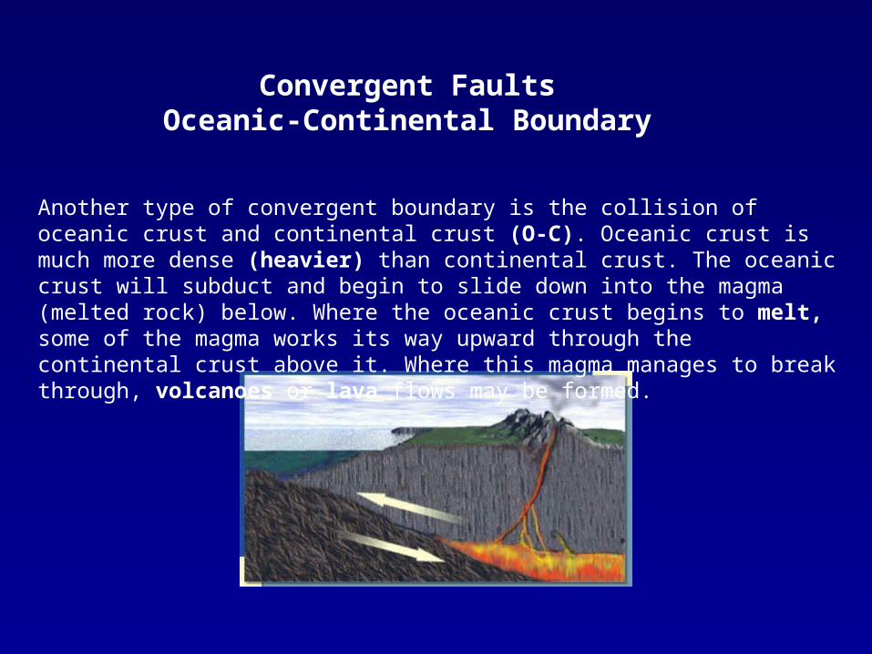
Another type of convergent boundary is the collision of oceanic crust and continental crust (O-C). Oceanic crust is much more dense (heavier) than continental crust. The oceanic crust will subduct and begin to slide down into the magma (melted rock) below. Where the oceanic crust begins to melt, some of the magma works its way upward through the continental crust above it. Where this magma manages to break through, volcanoes or lava flows may be formed.
Convergent FaultsOceanic-Continental Boundary
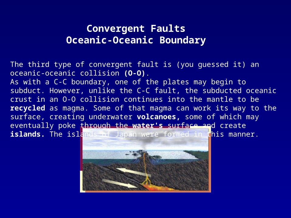
Convergent FaultsOceanic-Oceanic Boundary
The third type of convergent fault is (you guessed it) an oceanic-oceanic collision (O-O). As with a C-C boundary, one of the plates may begin to subduct. However, unlike the C-C fault, the subducted oceanic crust in an O-O collision continues into the mantle to be recycled as magma. Some of that magma can work its way to the surface, creating underwater volcanoes, some of which may eventually poke through the water's surface and create islands. The islands of Japan were formed in this manner.
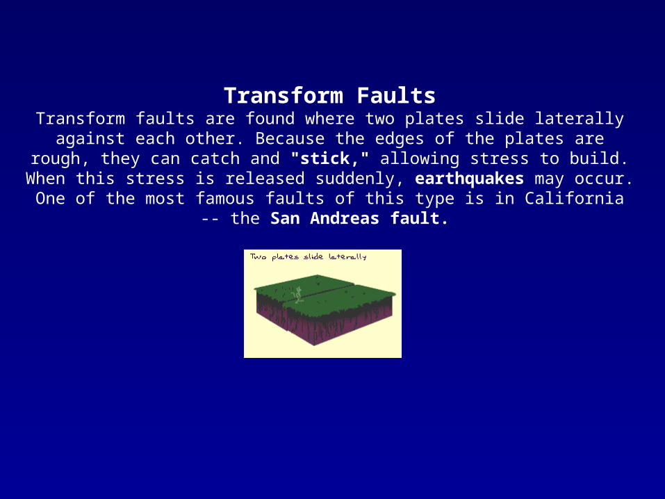
Transform FaultsTransform faults are found where two plates slide laterally against each other. Because the edges of the plates are rough, they can catch and "stick," allowing stress to build. When
this stress is released suddenly, earthquakes may occur. One of the most famous faults of this type is in California -- the San Andreas fault.