addressing land tenure issues following natural … · addressing land tenure issues following...
TRANSCRIPT
©FA
O/G
. Nap
olit
ano
Environmental context
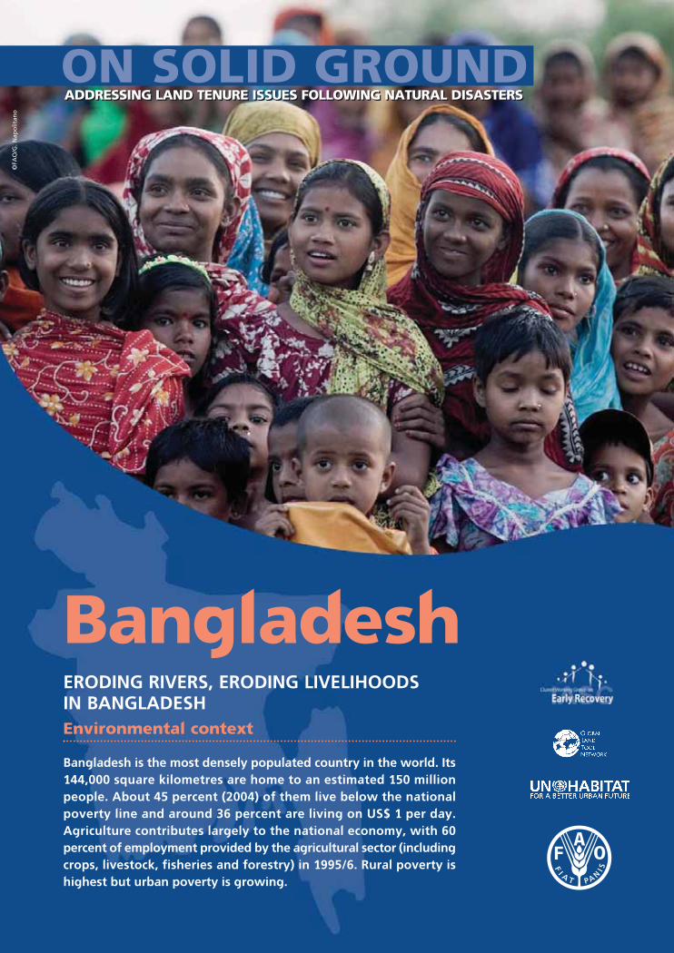
Bangladesh is the most densely populated country in the world. Its144,000 square kilometres are home to an estimated 150 millionpeople. About 45 percent (2004) of them live below the nationalpoverty line and around 36 percent are living on US$ 1 per day.Agriculture contributes largely to the national economy, with 60percent of employment provided by the agricultural sector (includingcrops, livestock, fisheries and forestry) in 1995/6. Rural poverty ishighest but urban poverty is growing.
ERODING RIVERS, ERODING LIVELIHOODS IN BANGLADESH
Bangladesh
ON SOLID GROUNDADDRESSING LAND TENURE ISSUES FOLLOWING NATURAL DISASTERSADDRESSING LAND TENURE ISSUES FOLLOWING NATURAL DISASTERS
2 On solid ground: BANGLADESH2
Bangladesh is also among the most disaster-prone
countries in the world, Between 1970 and 1998, the
country experienced 170 large-scale disasters. The
frequency and intensity/scale of floods have increased,
with eight major floods between 1974 and 2004. With
the current climate change, triggered by man-made
disasters (e.g. deforestation, soil erosion) it is expected
that the scale, intensity and frequency of disasters
will continue to increase. This means that people in
Bangladesh will have to cope with the impacts of
floods, river erosion, cyclones and other natural
disasters on a more regular basis.
The geographical setting of Bangladesh makes the
country particularly vulnerable to natural disasters.
The mountains and hills bordering almost three-fourths
of the country, along with the funnel shaped Bay of
Bengal in the south, have made the country a meeting
place of life-giving monsoon rains, but also subject it
to the catastrophic ravages of natural disasters. The
country is located in the low-lying Ganges-Brahmaputra
river delta, which is one of the most fertile plains in
the world. At the same time it is extremely vulnerable
to floods, river erosion and cyclones, as well as politically
motivated conflicts over water issues since most rivers
originate outside of the country. Upstream activities
such as deforestation increase the magnitude of
damages caused by floods.
The task of sustaining the very limited resource base
– land, in particular – is aggravated by population
growth, poverty and over-exploitation, with
consequent environmental degradation. This in turn
adds to the country’s vulnerability to natural disasters,
especially floods and river erosion, which have a
high impact on land tenure and land use issues.
Flooding. Many parts of Bangladesh are flooded
every year by heavy rainfall and the overflow of river
banks. Most parts of the country are less than 12
metres above sea level, and it is believed that about
50 percent of the land would be flooded if the sea
level were to rise by 1 metre.
Due to high population pressure and skewed land
ownership patterns, farming households and
settlements, primarily poor ones, are increasingly
pushed onto marginal land in high-risk flood areas.
One important example of such marginal, flood-
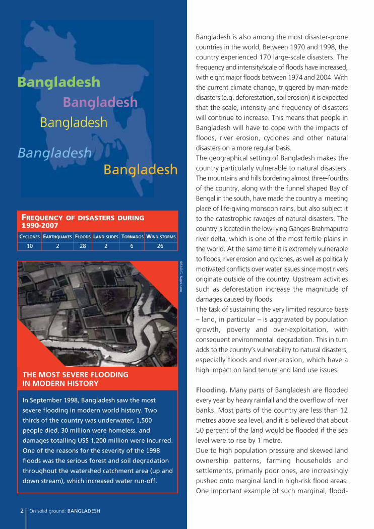
FREQUENCY OF DISASTERS DURING1990-2007
CYCLONES EARTHQUAKES FLOODS LAND SLIDES TORNADOS WIND STORMS
10 2 28 2 6 26
In September 1998, Bangladesh saw the most
severe flooding in modern world history. Two
thirds of the country was underwater, 1,500
people died, 30 million were homeless, and
damages totalling US$ 1,200 million were incurred.
One of the reasons for the severity of the 1998
floods was the serious forest and soil degradation
throughout the watershed catchment area (up and
down stream), which increased water run-off.
©FA
O/G
. Napolitano
THE MOST SEVERE FLOODING IN MODERN HISTORY
BangladeshBangladesh
Bangladesh
BangladeshBangladesh
prone areas are the highly unstable chars (temporary
state-owned lands within and adjoining the major
rivers). As these chars can be ‘new’ land arising from
sand deposits, land ownership of these areas is at
times highly disputed.
River erosion. River erosion is a serious threat that
people living along the rivers and the coastal areas
have to face on a daily basis. Given the population
density and unequal land distribution, many poor
rural people are forced to live in flood- and erosion-
prone areas along the rivers and the coast. It has
been estimated that at least 20,000 families become
homeless due to river bank erosion every year, and
are forced to migrate within the locality or to urban
areas, thus contributing to the growing number of
urban poor. When river erosion occurs very fast and
suddenly, people can lose everything overnight. In
other instance, river erosion is more gradual and
people have time to move their assets but loss of
cultivatable land and homestead is inevitable.
River erosion is sometimes referred to as the silent
tsunami, given the magnitude of its consequences.
For example, between 1981 and 1992, 728,000
people were displaced by river erosion, or an average
of 64,000 people each year. In char areas, the figures
are even higher: more than 250,000 people become
On solid ground: BANGLADESH 3
victims of land erosion every year, and annual
economic losses are estimated at TK 1,000 crore
(about US$ 145,350). Many of the people losing
their land have no other options than moving to
major urban centres, and some end up as pavement
dwellers, with even a slum shack beyond their reach.
The Centre for Environmental and Geographic
Information Services (CEGIS) has calculated that
155,280 hectares of land have been eroded between
1973 and 2007. Moreover, CEGIS forecasts that in
the coming years, about 29,000 people living along
the major rivers will lose their homes and land each
year. What is most worrying is the increasing
frequency and intensity of the erosion in recent years.
©FA
O/G
. Napolitano
River erosion also affects national borders. According to a government estimate,
the country has already lost nearly15,000 hectares of its land
due to erosion caused by 15 common rivers
with India and Myanmar.
«
»
4 On solid ground: BANGLADESH
©FA
O/G
. Napolitano
• Droughts. Although Bangladesh is a high-rainfall
country, droughts occur; the drought in 1973
contributed to the severe nation-wide famine in
1974. Often coinciding with seasonal drought is
the Monga period, when food stocks run out and
there are virtually no job opportunities in October
and November before the main harvest season
in December. The situation becomes worse if
preceded by a devastating flood. Thousands of
poor people go without adequate food for weeks.
According to estimates by the World Food
Programme, 80-90 percent of people (20-30
million) affected are agricultural day labourers
who are then forced to take consumption loans
and migrate to other areas for work, leaving
behind their families. They can also be forced to
give up sharecropped and/or owned land, leading
to a further concentration of land ownership.
• Earthquakes. The occurrence of small-magnitude
earthquakes in Bangladesh is quite frequent.
Earthquake records indicate that more than 100
moderate to large earthquakes have occurred
in Bangladesh since 1900, of which more than
65 took place after 1960. Fifteen new epicentres
have been identified inside Bangladesh since
January 2001. This clearly indicates an increased
frequency of earthquakes in the country.
• Landslides. Landslides often occur in the hilly areas
in and around Chittagong and the Chittagong
Hill tracts, triggered by incessant monsoon rains,
forest deforestation and hill cutting. Although
the links between deforestation, unsafe housing
development practices in hilly urban areas and
landslides are known and recognized, the
government is not taking any action.
FLOODING, RIVER EROSION, CYCLONES… AND MORE
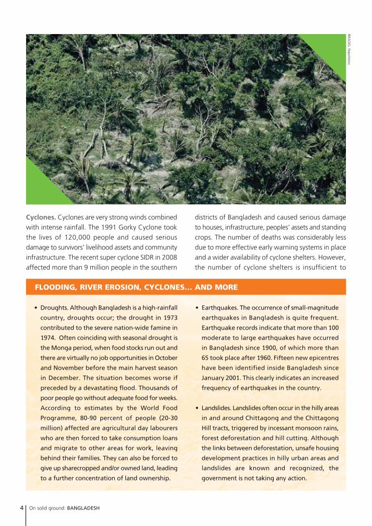
Cyclones. Cyclones are very strong winds combined
with intense rainfall. The 1991 Gorky Cyclone took
the lives of 120,000 people and caused serious
damage to survivors’ livelihood assets and community
infrastructure. The recent super cyclone SIDR in 2008
affected more than 9 million people in the southern
districts of Bangladesh and caused serious damage
to houses, infrastructure, peoples’ assets and standing
crops. The number of deaths was considerably less
due to more effective early warning systems in place
and a wider availability of cyclone shelters. However,
the number of cyclone shelters is insufficient to
accommodate the number of people in need of them.
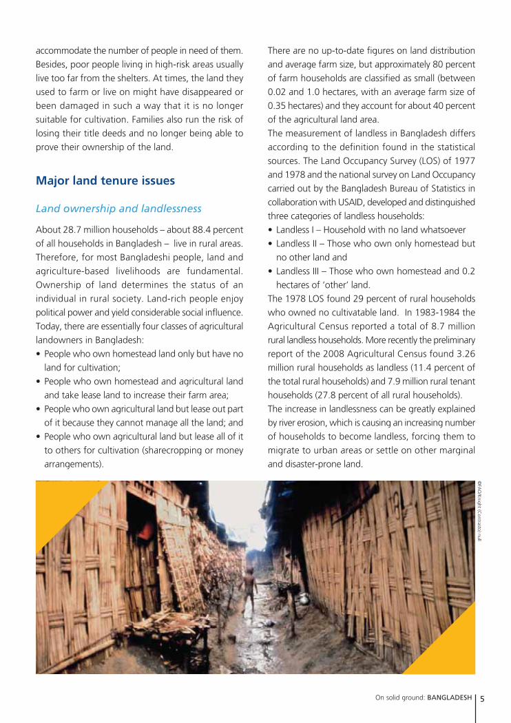
Besides, poor people living in high-risk areas usually
live too far from the shelters. At times, the land they
used to farm or live on might have disappeared or
been damaged in such a way that it is no longer
suitable for cultivation. Families also run the risk of
losing their title deeds and no longer being able to
prove their ownership of the land.
Major land tenure issues
Land ownership and landlessness
About 28.7 million households – about 88.4 percent
of all households in Bangladesh – live in rural areas.
Therefore, for most Bangladeshi people, land and
agriculture-based livelihoods are fundamental.
Ownership of land determines the status of an
individual in rural society. Land-rich people enjoy
political power and yield considerable social influence.
Today, there are essentially four classes of agricultural
landowners in Bangladesh:
• People who own homestead land only but have no
land for cultivation;
• People who own homestead and agricultural land
and take lease land to increase their farm area;
• People who own agricultural land but lease out part
of it because they cannot manage all the land; and
• People who own agricultural land but lease all of it
to others for cultivation (sharecropping or money
arrangements).
There are no up-to-date figures on land distribution
and average farm size, but approximately 80 percent
of farm households are classified as small (between
0.02 and 1.0 hectares, with an average farm size of
0.35 hectares) and they account for about 40 percent
of the agricultural land area.
The measurement of landless in Bangladesh differs
according to the definition found in the statistical
sources. The Land Occupancy Survey (LOS) of 1977
and 1978 and the national survey on Land Occupancy
carried out by the Bangladesh Bureau of Statistics in
collaboration with USAID, developed and distinguished
three categories of landless households:
• Landless I – Household with no land whatsoever
• Landless II – Those who own only homestead but
no other land and
• Landless III – Those who own homestead and 0.2
hectares of ‘other’ land.
The 1978 LOS found 29 percent of rural households
who owned no cultivatable land. In 1983-1984 the
Agricultural Census reported a total of 8.7 million
rural landless households. More recently the preliminary
report of the 2008 Agricultural Census found 3.26
million rural households as landless (11.4 percent of
the total rural households) and 7.9 million rural tenant
households (27.8 percent of all rural households).
The increase in landlessness can be greatly explained
by river erosion, which is causing an increasing number
of households to become landless, forcing them to
migrate to urban areas or settle on other marginal
and disaster-prone land.
On solid ground: BANGLADESH 5
©FA
O/K
night (Contrasto) null
lost by river erosion and reappearing later on due to changes in river courses (accretion) would be owned by
the government and declared as khas land (state-owned land) for redistribution to poor and landless families.
The spirit of the Act was to rehabilitate poor landless people as well as minimize land grabbing and associated
violence often seen in flood plains and coastal areas. However, the Act could not be enforced as the land was
taken away from landless people by influential local elites and large farmers. Often lengthy litigations discouraged
many displaced landless farmers from filing a case and they lost their claims to their legitimate rights. Consequently,
the Sikosti–Poisti Act was amended in 1994 by stating that the accreted land should go back to the previous
owner provided it was developed within 30 years. Although this amendment seemed a way forward, there
were challenges in identifying and measuring the actual location or site. Moreover, the 30-year clause is too
long for poor farmers. Often they prefer to sell the submerged land to large land owners at below-market
prices. This amendment of the Act has led to many conflicts, lengthy litigations and often armed violence
centred around old and newly accreted areas of land.
The Sikosti-Poisti Act (Dilluvion-Alluvion Act),
formulated initially during British rule, was
adopted with some amendments in 1972, soon
after independence. The act stated that if any land
6 On solid ground: BANGLADESH
is officially state-owned land often located in marginal
areas along the coasts and rivers. Settlement on and
allocation of khas land is often highly disputed and
highly insecure from a legal tenure perspective.
Since its independence, the Government of Bangladesh
has enacted many laws and policies regarding the
distribution of khas land. However, the laws, supporting
regulations and policies are complicated and their
implementation is not always enforced. In 1972, after
a catastrophic cyclone in the coastal areas, the Land
Administration and Land Reforms Division began to
rehabilitate the landless by creating seven cluster villages
in the chars in Noakhali, Lakshmipur and Feni districts.
In 1987, the Ministry of Land launched the Land Reforms
Action programme, an initiative to strengthen and
ADDRESSING THE LANDLESS AND RIVER EROSION
©FA
O/G
. Napolitano
Distributing khas land
Many rural households have become landless after
cyclones, floods and river erosion. Floods often render
their lands unsuitable for cultivation and inhabitable.
Cyclones are often accompanied by floods and cause
the land to be washed away, along with the destruction
of dams, irrigation canals, houses, etc. After losing
their farm and homestead land, people have to find
new land and often settle on so-called khas land, which
On solid ground: BANGLADESH 7
enforce previous resettlement programmes for
distribution of Khas and unoccupied state-owned land
to landless families. Several resettlement programmes
such as Adarsha Gram (AG), Asrayan and Abashan have
been implemented, and some are ongoing. The
beneficiary families are selected through the local
administration and then settled in communities ranging
from 30-300 families. The families are provided with
government khas land for homesteads, agricultural and
community purposes and resources for income
generation, production and community development.
Khas land is legally reserved for distribution to landless
households as defined above. However, some groups
of landless households are excluded, such as households
headed by unmarried women or widows with only
daughters or no children at all. In addition, the
government has imposed ceilings (60 Bighas, or about
8 hectares) on land ownership to redistribute land from
holdings above the “ceiling” to the landless or those
with holdings below an efficient farm size.
So far progress in redistributing khas land has generally
been mixed due to vested interests of the landowning
class, lack of political will, the inefficiencies in the way
the local and national administration are organized,
and the absence of an updated, systematic and universally
accepted source of information on land resource
availability and land rights. Given the legal and
administrative complexities and associated transaction
costs, it is very difficult for poor, often illiterate people
to go to court and file land litigation cases. Many landless
families cannot ‘afford’ these delays and lengthy
processes and are forced to migrate to other rural or
Gaps and obstacles in accessing Khas land in rural areas
Steps Obstacles/Gaps
Identification • A large portion of land is not surveyed and/or not recorded
• Illegally occupied by influential people
Notification • Allegations are very common that such notifications are only passed on to contacts, friends and relations with some interested parties not finding out at all, or until it is too late
Application • Illiterate people cannot fill in the form and cannot apply themselves and depend on others to help creating obligations toward their ‘helpers’.
• A fee is often demanded for providing, completing or accepting the form
• False applications from large land owners
List names • Applications are (often falsely) screened out for being filled out incorrectly
Selection • Bribes are sometimes paid to pass the selection stage by legitimate and illegitimate applicants
Recording • Bribes must be paid at each stage
Distribution • The number of applications exceeds the available plots and many are unsuccessful
• Certificates are only handed out after payment of bribe
• Land is given to ineligible people
Utilization • Powerful people already own the land and block access and/or file a competing claim(often supported by false documentation)
• Rich or influential people demand a share of the produce
Follow Up • Powerful people bribe officials to swing outcome in their favour and/or threaten the recipient from proceeding
• Recipients cannot afford to proceed with case because of high expenses
Source: Reports of Care-Bangladesh and Political Economy of Khas Land in Bangladesh by Abul Barakat
KHAS DISTRIBUTION – THE NUMBERS
The estimated amount of total identified khas
land in Bangladesh is 1.2 million hectares, although
some claim this to be an underestimation. In 2001,
official sources claimed that about 44 percent of
325,000 hectares of agricultural khas land had
already been distributed among the landless
families. However, discrepancies arose when
checked at the local level. For example, figures
for Noakhali district put official estimates at 67
percent of available land redistributed, while direct
enquiry at the local level showed a target
fulfillment of only 17 percent by mid 1990. In
several other cases, while distribution was shown
to have been completed on paper, reality showed
that no actual transfers had taken place.
urban areas in search of viable livelihood options. In
addition, continuing river erosion affects the resettlement
programmes as some of the rehabilitated villages have
disappeared. And one must not overlook the highly
disaster-prone agro-ecological environment in which
these programmes have to operate.
Besides the challenges of land tenures issues, resettlement
programmes have a number of other weaknesses:
• They often lack an understanding of living and
livelihood patterns of the affected populations, which
is reflected in the structural design and spatial
arrangements of shelters and homesteads.
• The location of resettlement villages is often far away
from local markets, commercial hubs and access to
services like health, government services and credit
facilities. Remoteness limits the scope of livelihood
options and income-generating opportunities.
• Settlements are at times not well planned and often
take up grazing grounds of nearby villages, leading
to conflicts over resource use and scarcity of locally
available livestock fodder.
Effective policies for those who lose theirland due to natural disasters
Although the Land Reform Ordninance of 1984
included provisions to protect people from being
evicted from their homesteads and recognized the
rights of sharecroppers, there are no proper and
effective policies in place for people who lose land
due to river erosion or floods.
There are several reasons for the lack of progress in
the formulation of a realistic land policy vis-à-vis
natural disasters, and its effective implementation:
• Land constraints. In Bangladesh per capita availability
of cultivable land stands at a miniscule .09 hectares,
indicating a very limited scope for any comprehensive
redistribution of land. Insufficient appreciation of
the overall land constraints has led to an ineffective
attention to redistributive land reform. Important
issues like the optimal utilization of public or state
land resources including urban land have been
relatively neglected. In addition to the already
existing landless households, the opportunities for
resettlement of households affected by natural
disasters are limited.
8 On solid ground: BANGLADESH
• Regional variation in land resources. There has
been a general lack of awareness of the regional
variation with regard to land resources and land
problems. An important example is the availability
of khas land for redistribution to the rural poor. Bulk
availability of khas land is concentrated in relatively
regional few pockets. A successful implementation
of khas land redistribution demands a concentration
of efforts in these identifiable regional pockets rather
than a single approach for the whole country.
• Bottlenecks for the implementation of land
reform. The history of implementation of land
reform has been full of failures and bottlenecks.
Arguments like lack of political will are insufficient
explanation for such failures. The inefficiencies
both in the system of land administration and the
associated court process, and in the work of ex-
officio authorities in key decision making positions
on land reform programmes, could be at the root
of such implementation failures.
The issues of implementation failures and land
violence call for a land administration reform
besides redistributive and tenure reforms. Land
governance should be a key issue in such land
administration reform, which should also consider
issues related to disasters and land tenure and be
linked to current disaster management and
response frameworks and policies.
• Absence of any centralized system of information
on land resources and land rights. While a great
deal of information exists, it is scattered and/or
«
»
Flaws in the land administration system also
contribute significantly to anotherlittle appreciated source of ruralmisery, namely pervasive land
violence. Land violence is alreadyvery much part of daily reality but tensions and violence are
further aggravated after morehouseholds have lost land due to
floods and river erosion.
On solid ground: BANGLADESH 9
©FA
O/G
. N
apol
itano
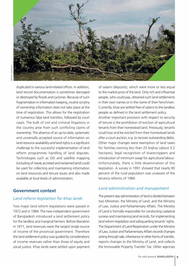
duplicated in various land-related offices. In addition,
land record documentation is sometimes damaged
or destroyed by floods and cyclones. Because of such
fragmentation in information keeping, routine scrutiny
of ownership information does not take place at the
time of registration. This allows for the registration
of numerous false land transfers, followed by court
cases. The bulk of civil and criminal litigations in
the country arise from such conflicting claims of
ownership. The absence of an up-to-date, systematic
and universally accepted source of information on
land resource availability and land rights is a significant
challenge to the successful implementation of land
reform programmes handling of land disputes.
Technologies such as GIS and satellite mapping
(including of newly accreted and reclaimed land) could
be used for collecting and maintaining information
on land resources and tenure issues and also made
available at local levels of administration.
Government context
Land reform legislation for khas lands
Two major land reform legislations were passed in
1972 and in 1984. The new independent government
of Bangladesh introduced a land settlement policy
for the landless and marginal farmers. Before liberation
in 1971, land revenues were the largest single source
of income of the provincial government. Therefore
the land settlement policy was guided by considerations
of income revenues rather than those of equity and
social justice. Khas lands were settled upon payment
of salami (deposits), which were more or less equal
to the market price of the land. Only rich and influential
people, who could pay, obtained such land settlements
in their own names or in the name of their henchmen.
Currently, khas are settled free of salami to the landless
people as defined in the land settlement policy.
Another important provision with respect to security
of tenure is the prohibition of eviction of agricultural
tenants from their homestead land. Previously, tenants
could lose and be evicted from their homestead lands
after a court auction, e.g. to recover outstanding debts.
Other major changes were exemption of land taxes
for families owning less than 25 bighas (about 3.2
hectares), legal recognition of sharecroppers and
introduction of minimum wage for agricultural labour.
Unfortunately, there is little dissemination of this
legislation. A survey in 1991 showed that nearly 90
percent of the rural population was unaware of the
tenancy reforms of 1984.
Land administration and management
The present-day administration of land is divided between
two Ministries: the Ministry of Land; and the Ministry
of Law, Justice and Parliamentary Affairs. The Ministry
of Land is formally responsible for conducting cadastral
surveys and maintaining land records, for implementing
land reform legislation and safeguarding tenants’ rights.
The Department of Land Registration under the Ministry
of Law, Justice and Parliamentary Affairs records changes
arising through sale, inheritance or other forms of transfer,
reports changes to the Ministry of Land, and collects
the Immovable Property Transfer Tax. Other agencies
10 On solid ground: BANGLADESH
playing a more minor part in the administration of land
include the Ministry of Forests, the Fisheries Department,
the Directorate of Housing and Settlement, and the
Department of Roads and Railways.
Land administration covering legal and fiscal cadastre
is run through the administrative units of the country.
The country is divided into six divisions headed by
Divisional Commissioners.
The six divisions are divided into 64 districts, headed
by a collector who is also the District Magistrate and
Deputy Commissioner. The collector is responsible
for the entire land revenue administration in the
district, approving settlement of government land
and changes in classification of land according to
their usage and acquisition of land for development.
The districts are further divided into 465 sub-districts,
the upazila, which is the basic administrative unit.
The central government at this level is represented
by the Upazila Nirbahi Officer who, among other
tasks, supervises the revenue administration in the
area. There are several Tahsil offices in each Upazila,
which are local field units for collecting land revenue.
Institutional arrangements related todisaster management and land tenure
The Ministry of Food and Disaster Management
(MoFDM) is responsible for coordinating national disaster
management efforts across all agencies such as the
Disaster Management Bureau, and the Directorate of
Relief and Rehabilitation. The MoFDM is responsible
for coordinating early warning management systems,
coordinating immediate relief operations and recovery
and rehabilitation programs. The Ministry is supported
by donors and several UN agencies that provide
technical support and funding assistance, and also a
number of national and international NGOs. A series
of inter-related institutions, at both national and sub-
national levels have been created to ensure effective
planning and coordination of disaster risk reduction
and emergency response management.
Other ministries such as the Ministry of Agriculture
and the Ministry of Public Works and Housing are called
upon for certain disaster responses (for example, the
Ministry of Public Works and Housing in relation to
earthquakes – for coordinating reconstruction efforts
and ensuring a proper implementation of the building
code). The Ministry of Agriculture is responsible for
research and extension activities to support the farmers
during droughts.
Strengthening the response
Creating guidelines that specifically address land
tenure and disasters.The National Disaster Management
Plan 2008-2015 outlines guidelines and procedures
for Union Disaster Management Plans (UDMP) for each
Union, outlining both disaster risk reduction strategies
and emergency responses. Union Disaster Management
Committees must conduct participatory community
risk assessments with particular attention to specific
vulnerable groups within communities. However, the
guidelines developed for the community risk assessment
do not include issues around land tenure and disasters.
Although the Union and Disaster Management
Committees should be responsible for monitoring and
maintaining primary contact with landless families
©FA
O/G
. Napolitano
«
»
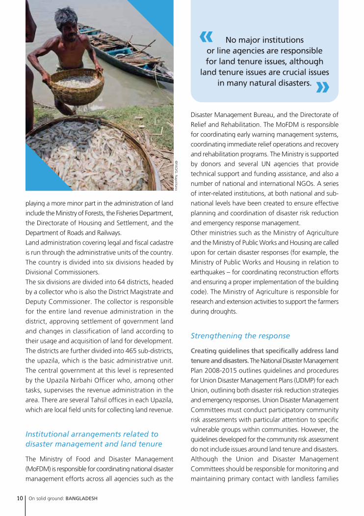
No major institutions or line agencies are responsible for land tenure issues, although
land tenure issues are crucial issuesin many natural disasters.
On solid ground: BANGLADESH 11
during pre- and post-disasters period, due to lack of
resource and policy guidelines, this is not happening.
They only certify landless families in response to a specific
khas land resettlement programme.
Their duties and responsibilities in relation to land
tenure issues could be strengthened as follows:
• During participatory community risks assessments,
include information on land ownership distribution
and reasons for landlessness and identification
of landless families and those vulnerable to losing
land due to future disasters.
• Capacity building and preparedness measures
should include identification of available land for
rehabilitation at the union/ward level.
• People living in areas identified as risk spots should
submit copies of their land titles to the upazila
and district administration as proof of their
ownership. In the event of loss of property, they
could claim for rehabilitation.
• During reconstruction of shelters, agencies should
make sure that beneficiaries have safe and secure
places in their homes to store their valuables
including land deeds, maps etc.
Reducing vulnerability to disasters. While it is
impossible to prevent natural events such as the SIDR
Cyclone and major floods, it is possible to reduce
vulnerability to disasters of people living in disaster-
prone areas. Initiatives such as early warning systems
showed their merits during the SIDR cyclone in 2007,
as the death toll of around 4,000 was far less than
the previous major cyclone in 1991, which caused
120,000 deaths. Disaster preparedness programmes
make communities aware of their needs and teach
them how to cope with disasters, not only in terms
of saving their own lives but also in identifying ways
of protecting their livelihoods. They must be directly
engaged in the design and management of early
warning systems (including choice of message
dissemination) and construction of locally appropriate
infrastructure such as multi-purpose cyclone shelters
and well-maintained embankments.
Strengthening Disaster Management Committees.
DMCs at district, upazila and village or levels should
take the main lead in planning and implementing
community-based disaster preparedness plans to
disasters likely to affect their areas. The DMCs should
have a broad membership that includes community
representatives such as fishers and farmers. In
addition, the government must accelerate its efforts
to tackle chronic vulnerability by guaranteeing access
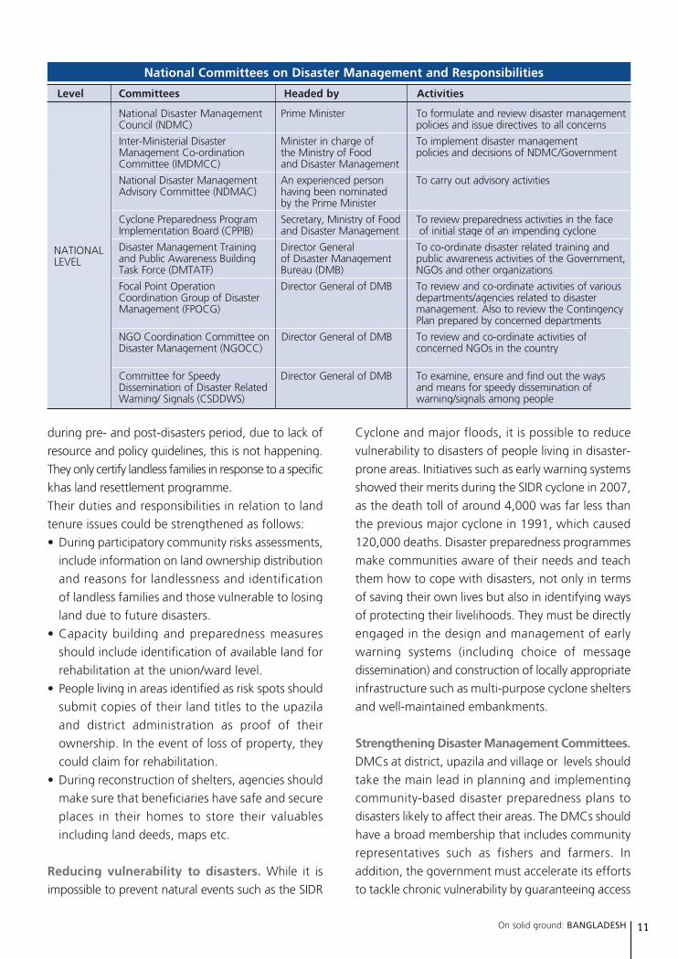
National Committees on Disaster Management and Responsibilities
Level Committees Headed by Activities
National Disaster Management Prime Minister To formulate and review disaster managementCouncil (NDMC) policies and issue directives to all concerns
Inter-Ministerial Disaster Minister in charge of To implement disaster management Management Co-ordination the Ministry of Food policies and decisions of NDMC/GovernmentCommittee (IMDMCC) and Disaster Management
National Disaster Management An experienced person To carry out advisory activitiesAdvisory Committee (NDMAC) having been nominated
by the Prime Minister
Cyclone Preparedness Program Secretary, Ministry of Food To review preparedness activities in the face Implementation Board (CPPIB) and Disaster Management of initial stage of an impending cyclone
Disaster Management Training Director General To co-ordinate disaster related training andand Public Awareness Building of Disaster Management public awareness activities of the Government,Task Force (DMTATF) Bureau (DMB) NGOs and other organizations
Focal Point Operation Director General of DMB To review and co-ordinate activities of variousCoordination Group of Disaster departments/agencies related to disasterManagement (FPOCG) management. Also to review the Contingency
Plan prepared by concerned departments
NGO Coordination Committee on Director General of DMB To review and co-ordinate activities of Disaster Management (NGOCC) concerned NGOs in the country
Committee for Speedy Director General of DMB To examine, ensure and find out the ways Dissemination of Disaster Related and means for speedy dissemination ofWarning/ Signals (CSDDWS) warning/signals among people
NATIONALLEVEL
CONTACT:
FAO. Land Tenure andManagement Unit. Mr. Paul Munro-Faure. Chief. [email protected]. Adriana Herrera GaribayLand Tenure [email protected]
UN-HABITAT. Land, Tenure andProperty Administration SectionShelter Branch. Ms. Clarissa Augustinus [email protected]
FAO REPRESENTATION IN BANGLADESHFAO Representative: Mr. Ad [email protected] [email protected]
to essential services including health, education,
water, and sanitation during any type of disasters,
giving priority to the vulnerable and poor.
Considering land tenure in resettlement programmes.
Post-disaster rehabilitation support, including land tenure,
require more attention from policy makers and
coordination among government bodies and local
institutions. For example, during early recovery stages,
agencies in charge of resettlement planning and
programmes must determine that the resettlement areas
identified are not located in hazardous zones and that
the lease deeds for land ownerships are clear and
registered to ensure tenure security for the resettled
households. Also the beneficiary households should be
well identified and belong to the most affected and
needy category of households. Too often, resettlement
programmes are not implemented with care, causing
problems during implementation and for the long term.
For example, people are again affected by natural
disasters because they have been resettled in marginal,
disaster-prone areas or land titles deeds registration is
disputed, leading to land settlement disputes or violence.
information about major forms of land use, land ownership patterns, physical structures (such as houses, schools,
clinics, water wells, markets, important roads), disaster-prone/vulnerable areas (e.g. steep slopes, flood-prone
areas, ground water conditions) and environmental issues. These maps should be widely shared and easily accessible
by the communities and can serve as a first step in the planning process for disaster preparedness programmes.
Such programmes will be able to address issues on projected population growth, infrastructure development
needs, main sources of income and include environmental components such as conservation areas. These maps and
plans can also be used as an effective tool to help communities become more aware of the major disaster areas in
their communities, the implications and possible plans to mitigate their occurrence and impact.
Participatory disaster mapping is a valid tool in
supporting and planning community-based
disaster preparedness programmes. Maps are
drawn by the communities highlighting important
PARTICIPATORY DISASTER MAPPING
LAND TENURE AND RELATED INSTITUTIONS
Ministry of LandMinistry of Law, Justice and Parliamentary Affairs,Department of Land RegistrationMinistry of Forests, Fisheries Department,Directorate of Housing and Settlement, and theDepartment of Roads and RailwaysNational Disaster Management Council (NDMC)Inter-Ministerial Disaster Management Co-ordination Committee (IMDMCC)National Disaster Management AdvisoryCommittee (NDMAC)Cyclone Preparedness Program ImplementationBoard (CPPIB)Disaster Management Training and PublicAwareness Building Task Force (DMTATF)Focal Point Operation Coordination Group ofDisaster Management (FPOCG)NGO Coordination Committee on DisasterManagement (NGOCC)Committee for Speedy Dissemination of DisasterRelated Warning/ Signals (CSDDWS)
Capturing the relationship between land tenure
issues and natural disasters in key policy frameworks.
The relationship between land tenure issues and disasters
is not reflected and integrated in several key policy
frameworks such as the Poverty Reduction Strategy Paper,
the National Plan on Disaster Management 2008-2015
and the Standing Order on Disasters. In practice, there
needs to be a stronger link between land distribution
and resettlement programmes and disaster preparedness
and rehabilitation programmes.