390 a map of the world in two hemispheres a map of the world in two hemispheres. rome, michael...
TRANSCRIPT
#390
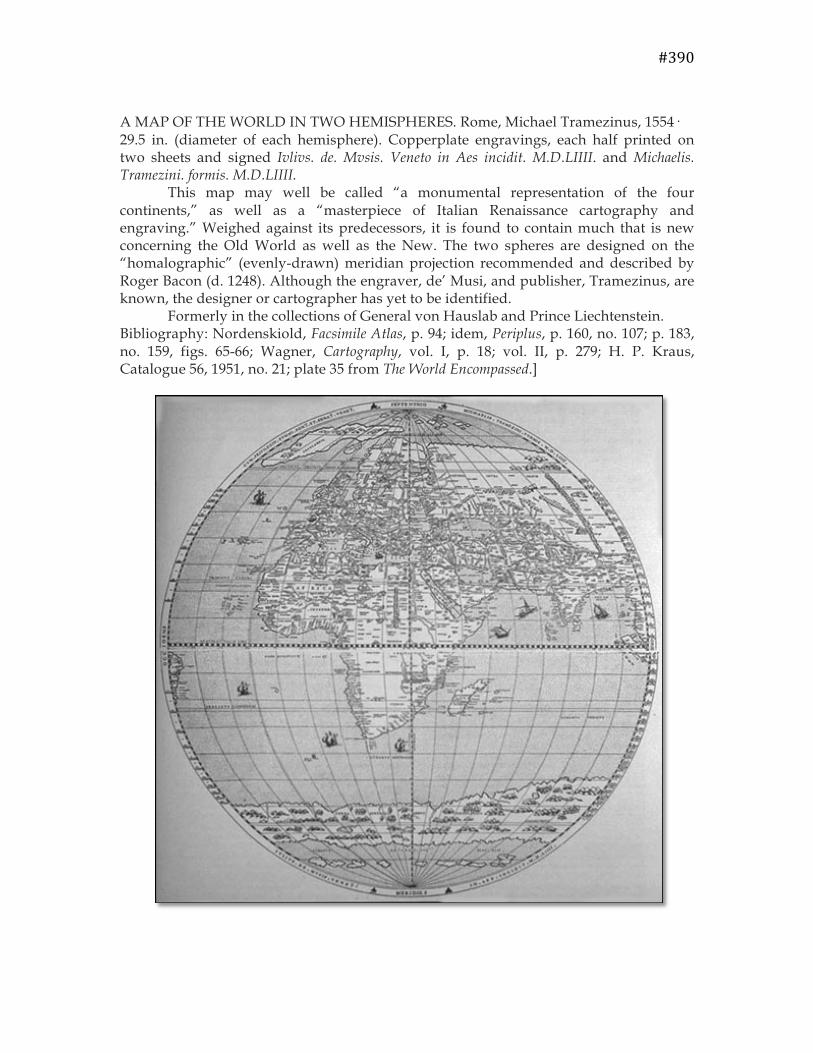
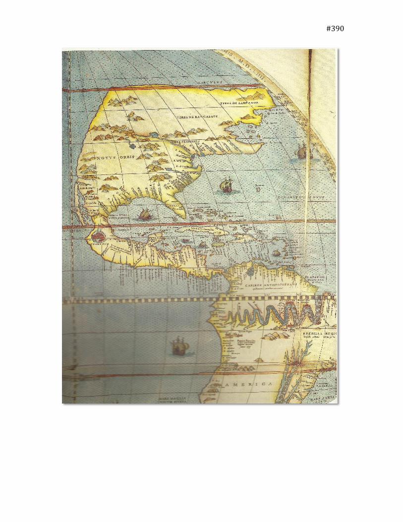
A MAP OF THE WORLD IN TWO HEMISPHERES. Rome, Michael Tramezinus, 1554· 29.5 in. (diameter of each hemisphere). Copperplate engravings, each half printed on two sheets and signed Ivlivs. de. Mvsis. Veneto in Aes incidit. M.D.LIIII. and Michaelis. Tramezini. formis. M.D.LIIII. This map may well be called “a monumental representation of the four continents,” as well as a “masterpiece of Italian Renaissance cartography and engraving.” Weighed against its predecessors, it is found to contain much that is new concerning the Old World as well as the New. The two spheres are designed on the “homalographic” (evenly-drawn) meridian projection recommended and described by Roger Bacon (d. 1248). Although the engraver, de’ Musi, and publisher, Tramezinus, are known, the designer or cartographer has yet to be identified. Formerly in the collections of General von Hauslab and Prince Liechtenstein. Bibliography: Nordenskiold, Facsimile Atlas, p. 94; idem, Periplus, p. 160, no. 107; p. 183, no. 159, figs. 65-66; Wagner, Cartography, vol. I, p. 18; vol. II, p. 279; H. P. Kraus, Catalogue 56, 1951, no. 21; plate 35 from The World Encompassed.]
#390
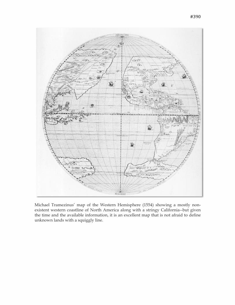
Michael Tramezinus’ map of the Western Hemisphere (1554) showing a mostly non-existent western coastline of North America along with a stringy California--but given the time and the available information, it is an excellent map that is not afraid to define unknown lands with a squiggly line.
#390
#390
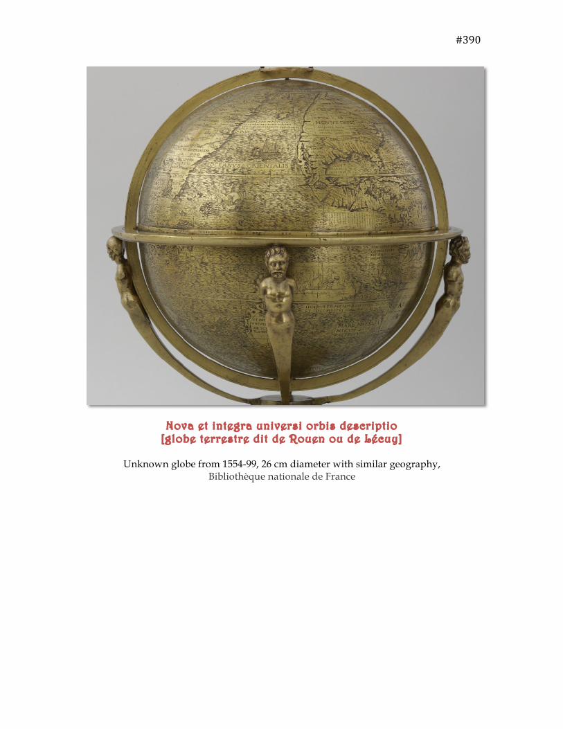
Nova et integra universi orbis descriptio [globe terrestre dit de Rouen ou de Lécuy]
Unknown globe from 1554-99, 26 cm diameter with similar geography,
Bibliothèque nationale de France